

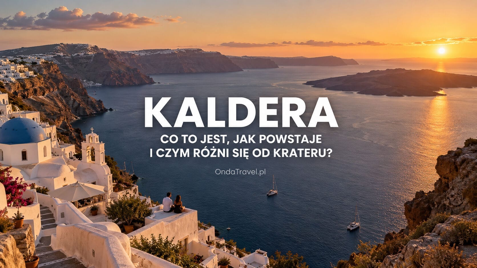
What Is a Caldera? How It Forms and How It Differs from a Crater
A caldera is one of the most commonly misunderstood volcanic landforms. Popular descriptions sometimes present it as a “very large crater”, the remains of a gigantic explosion, or even a synonym for a supervolcano. Each of these shortcuts can create a misleading picture of how a volcanic system actually works.
In simple terms, a caldera is a broad volcanic depression formed primarily when part of a volcanic system collapses after a substantial amount of magma has been erupted, withdrawn or displaced. The key process is collapse, not simply the explosion itself or the size of the depression.
In this guide, I explain not only what a caldera is and how a volcanic caldera forms, but also how it differs from a crater, why not every caldera is a supervolcano, how caldera lakes develop, and why Toba, Yellowstone, Ngorongoro, Taupō, Campi Flegrei, Crater Lake, Askja and Santorini can look completely different even though they all belong to the same broad family of volcanic structures.
Caldera — at a glance
A caldera is a broad volcanic depression formed primarily when part of a volcanic system collapses after a substantial volume of magma has been erupted, withdrawn or displaced. It is not simply a large crater, and not every caldera is a supervolcano.
Table of contents
- What is a caldera?
- How large can a caldera be?
- How does a caldera form step by step?
- Does a caldera always form after a major explosion?
- Caldera vs crater — what is the difference?
- Is a caldera a volcano or a landform?
- Caldera vs supervolcano
- Can a caldera contain a lake?
- Famous calderas around the world
- What is the largest caldera in the world?
- Santorini caldera
- Akrotiri and the Santorini eruption
- Do all calderas look the same?
- Calderas in Iceland
- FAQ — common questions about calderas

Check out my YouTube channel and travel with me.
Follow the channel for videos, routes and practical travel inspiration.
Follow me here:
What’s up?
Enjoying my content?
Buy me a coffee at buycoffee.to/ondatravel and support the creation of more travel content.
Your support helps me create more practical guides, videos and travel inspiration.

What is a caldera?
In geography and volcanology, a volcanic caldera is a large depression associated with the collapse of part of a volcanic system. This most often happens when a substantial volume of magma is removed from its storage zone during an eruption or moves elsewhere within the system.
The rocks above such a system are not simply “hanging” over one enormous empty cave. Real magma-storage regions can consist of many lenses, dikes, intrusions and partially molten rock. It is therefore more accurate to think in terms of a magma system or magma reservoir rather than a single giant hollow chamber that suddenly empties completely.
When conditions beneath the surface change sufficiently, the overlying rocks can fracture and subside. A section of the surface then drops along faults, creating a broad depression. This collapse mechanism is one of the main reasons a caldera differs from a classic eruptive crater.
Volcanic activity does not necessarily end after a caldera forms. New vents, cones, lava domes, geothermal areas, eruptions and ground deformation can later develop within it. A caldera is therefore part of the history of a volcanic system, not its “tombstone”.
How large can a caldera be?
The USGS glossary gives a typical caldera diameter range of about 2–50 km. The National Park Service uses a broader rule of thumb and notes that the boundary between a large crater and a small caldera is not perfectly sharp; in practice, depressions wider than roughly 1 km may be classified as calderas when their formation mechanism supports that interpretation.
Size alone is therefore not enough. The most important question is: how did the depression form? Two structures with similar diameters may have completely different origins. At the other extreme, a gigantic caldera tens of kilometres across can be so large that a person standing inside it may not even see the opposite rim.
This matters for travellers as well. Yellowstone, Campi Flegrei and Toba are difficult to perceive as single “craters”. Their scale is closer to an entire landscape than to one isolated volcanic landform.
How does a caldera form? Step by step
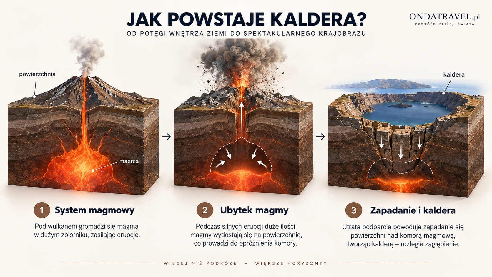
Caldera formation is a process driven by changing conditions throughout a magma system. You do not need to imagine an explosion mechanically blasting out a perfectly circular hole. In many cases, the largest change in the landscape occurs because rocks above the magma system lose part of their support and begin to collapse.
1. Magma accumulates and moves through the system
Before a caldera forms, magma may spend a long time accumulating, crystallising, mixing and moving through the crust. The system is not static. New batches of magma can enter it, while pressure, temperature and gas content change over time.
During a large eruption, some of this magma may reach the surface. In other cases, magma can migrate laterally into a rift zone or feed an eruption elsewhere. What matters for caldera formation is a sufficiently large change in magma volume and in the support available to the rocks above.
2. Collapse of the crustal block — the key mechanism
As conditions below the surface change, fractures and faults can develop. A block of rock may begin to subside. This subsidence can affect an area many times larger than a single volcanic vent.
This is why describing a caldera as a “huge crater left by an explosion” is too simplistic. In many calderas, surface collapse played the central role in producing the depression we see today, rather than the explosive removal of rock alone.
Does a caldera always form after a major explosion?
No. The best-known calderas are often associated with extremely powerful explosive eruptions, but the National Park Service also describes non-explosive calderas, including examples formed on large shield volcanoes.
In these systems, magma can be drained away from the summit region during a lava eruption on a flank or within a rift zone. If enough support is removed, the summit area can collapse without a single catastrophic explosion.
This distinction separates the idea of a caldera from that of a supereruption. A caldera describes a structure and a collapse process; it does not automatically tell us how violent the associated event was.
Resurgent dome — what can happen after collapse?
The history of a caldera does not end when the collapse occurs. In some volcanic systems, part of the caldera floor is later uplifted again. This broad uplifted structure is known as a resurgent dome.
Long Valley in California is a good example. The USGS describes a broad area of the caldera floor that was uplifted after the caldera-forming eruption. Processes like these help explain why the interior of an old caldera can develop into a geologically complex landscape over time.
Toba also shows that the floor of a caldera can be uplifted after a major eruption. Samosir is associated with post-caldera resurgence, which is why Lake Toba is not simply a body of water occupying a perfectly flat basin.
Caldera vs crater — what is the difference?
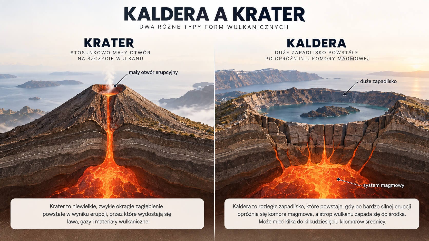
Searches such as “caldera vs crater” and “what is the difference between a caldera and a crater?” point to one of the most important distinctions in this subject. The difference is not simply that a caldera is larger.
| Feature | Caldera | Crater |
|---|---|---|
| Main formation mechanism | Collapse of a larger part of the volcanic system after substantial removal or displacement of magma | A feature more directly associated with a vent, an eruption or a smaller-scale collapse |
| Typical scale | From roughly a kilometre to tens of kilometres across | Usually much smaller |
| Relationship to vents | May contain multiple vents and younger volcanic structures | Usually more closely associated with a specific eruptive vent |
| Appearance | May appear as a lake, bay, basin, broad plain or even a structure hidden beneath ice | More often a clearly defined local depression |
| Later activity | New craters, cones, domes, eruptions and deformation may develop within it | Further activity may continue around the same vent |
The USGS notes that terminology also has a scale component: smaller collapse depressions are generally called craters, while larger ones are called calderas. The geological mechanism remains essential, however, so it is better not to define a caldera simply as “a crater larger than X kilometres”.
Why the confusion: is a caldera a volcano or a landform?
The answer is that the term can be used in both ways depending on context. The USGS and National Park Service note that a caldera may be a landform that is part of a larger volcano, while the term is also used for entire volcanic systems dominated by a caldera structure.
At the same time, classic classifications of major volcanic landforms list stratovolcanoes, shield volcanoes, cinder cones and lava domes separately. This is not a contradiction; it reflects the use of different classification criteria.
For that reason, the question “is a caldera a volcano?” does not have a useful one-word answer. The safest description is that a caldera is primarily a collapse structure related to volcanism, and it may become the dominant feature of an entire volcanic system.
Pit crater — a smaller collapse depression within a volcanic system
Another source of confusion is the term pit crater. The National Park Service describes pit craters as smaller depressions formed through subsidence or collapse. They can occur inside larger calderas, particularly in basaltic volcanic systems.
This shows that the word “crater” does not always mean a depression excavated by an explosion. Volcanology distinguishes these structures according to their origin, scale and position within the wider volcanic system.
If you want to see a completely different example of the interior of a volcanic system, take a look at my guide to Icelandic Þríhnúkagígur. It is not an example of a giant caldera, but it offers a very different perspective on the internal structure of a volcano.

Iceland · volcanoes
Þríhnúkagígur — a volcano you can descend into
See the OndaTravel guide to the extraordinary Icelandic volcano Þríhnúkagígur and explore the interior of its volcanic conduit.
Caldera vs supervolcano — why are they not synonyms?
Not every caldera is a supervolcano, and the two terms should not be used interchangeably. This is one of the most common misconceptions in popular descriptions of Yellowstone, Toba and Campi Flegrei.
The USGS primarily defines a supereruption as an event that ejects more than 1,000 km³ of volcanic material. This criterion refers to the scale of a particular eruption, not to a simple equation such as “large caldera = supervolcano”.
VEI 6–8 and the 1,000 km³ threshold
The National Park Service notes that calderas associated with large explosive eruptions commonly occur in connection with high-VEI events. The Volcanic Explosivity Index describes the relative explosiveness of an eruption and should not be treated as a direct measure of caldera size.
A very large caldera may therefore be associated with an exceptionally powerful eruption, but there are also smaller explosive calderas and calderas formed in systems dominated by effusive eruptions.
Basaltic calderas and calderas without supereruptions
Shield volcanoes provide a strong counterexample to the idea that “caldera = supervolcano”. In Hawaiʻi, calderas can form when magma drains away and the summit region collapses in connection with lava eruptions.
Iceland also contains complex caldera systems associated with basaltic magmatism, fissure activity and subglacial environments. The mere presence of a caldera is therefore not enough to conclude that a supereruption occurred in the past.
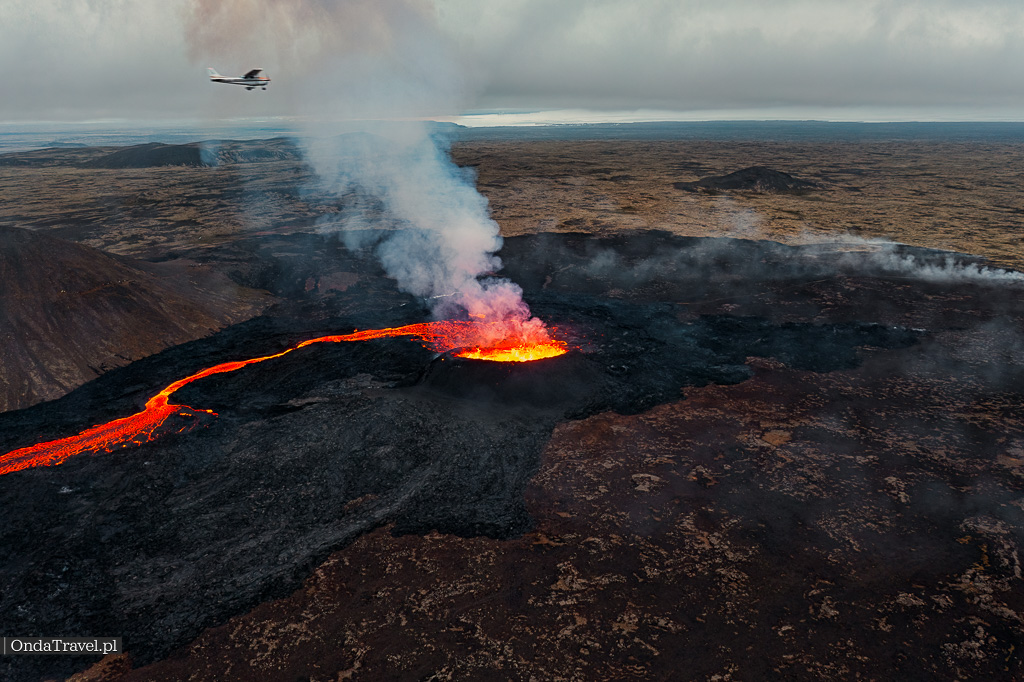
Modern Icelandic fissure volcanism provides a useful comparison. See my guide to the eruptions around Fagradalsfjall, Grindavík and Reykjanes, as well as my separate guide to the Reykjanes Peninsula. This landscape differs from a classic caldera and shows how many different forms active volcanism can take.
Can a caldera contain a lake? Caldera lakes and flooded calderas
A caldera is itself a depression, but over time it may become partly or completely filled with water. That water can come from rainfall, groundwater, melting snow and ice or, where the structure is connected to the sea, from seawater.
This is why the terms “caldera lake” and “crater lake” do not always describe the same type of geological feature. Tourist names can also be misleading. Crater Lake in Oregon actually occupies the large caldera of Mount Mazama.
Well-known examples include Lake Toba in Indonesia, Lake Taupō in New Zealand, Crater Lake in the United States and Öskjuvatn within the Askja system in Iceland. Santorini represents another variation: today, the Aegean Sea occupies a large part of its complex caldera system.
Famous calderas around the world
One of the best ways to understand calderas is to compare very different examples. There is no single “caldera look”. One may resemble an enormous lake, another a broad basin, another a densely populated urban region, and another an archipelago surrounding a flooded depression.
The table below summarises several important examples. I then look at them individually, because each one answers a slightly different question about how calderas form and evolve.
| Caldera | Where? | Why is it important? |
|---|---|---|
| Toba | Indonesia | About 35 × 100 km. The Smithsonian Global Volcanism Program describes it as Earth’s largest Quaternary caldera. Much of the structure is occupied by Lake Toba. |
| Yellowstone | United States | One of the world’s best-known calderas. The present caldera is about 70 × 45 km and forms part of an enormous volcanic and hydrothermal system. |
| Ngorongoro | Tanzania | UNESCO describes Ngorongoro as the world’s largest unbroken caldera. |
| Taupō | New Zealand | A broad caldera about 35 km across. A large part of it is occupied by present-day Lake Taupō. |
| Campi Flegrei | Italy | An active caldera about 12–15 km across, located west of Naples and closely monitored by Italy’s INGV. |
| Crater Lake / Mount Mazama | United States | The Mount Mazama caldera is about 8 × 10 km. After collapse roughly 7,700 years ago, the depression gradually filled with water to form Crater Lake. |
| Askja | Iceland | A complex system of three overlapping calderas. The youngest structure, about 4.5 km across, formed in connection with the 1875 eruption and is now occupied by Lake Öskjuvatn. |
| Santorini | Greece | A multi-stage system of partly overlapping calderas. Its modern appearance reflects a long history of eruptions, collapse and later volcanic activity. |
Toba — a giant caldera filled by a lake
Toba on Sumatra is one of the most spectacular examples of the scale a caldera system can reach. The Smithsonian Global Volcanism Program gives dimensions of about 35 × 100 km and describes Toba as Earth’s largest Quaternary caldera.
Lake Toba occupies much of the structure. Within it lies Samosir, associated with later uplift of the caldera floor. It is an excellent example of resurgence following a caldera-forming event.
Toba also demonstrates why a gigantic caldera should not be imagined as a crater viewed from a single lookout. At roughly one hundred kilometres long, it is better understood as an enormous geological landscape surrounding the observer.
Yellowstone — a caldera too large to see in full from the ground
The Yellowstone caldera measures about 70 × 45 km. The USGS links its present outline to the major eruption approximately 631,000 years ago and the subsequent collapse of the area above the magma system.
For travellers, Yellowstone is experienced mainly as geysers, hot springs, fumaroles, forests and a broad plateau. The contrast between the geological map and what is visible from a road or trail is an excellent demonstration of the scale of large calderas.
Yellowstone is also a useful place to separate neutral geological terminology from sensational uses of the word “supervolcano”. A caldera is a specific geological structure, while a supereruption describes the scale of an eruptive event.
Ngorongoro — the largest unbroken caldera according to UNESCO
Ngorongoro in Tanzania represents a very different kind of landscape. Its walls are clearly defined and the interior forms a broad enclosed basin.
UNESCO describes Ngorongoro as the largest unbroken caldera in the world. That wording matters because it helps explain why simple rankings of the “largest calderas” can appear to contradict one another.
Toba can be described by Smithsonian as the largest Quaternary caldera, while Ngorongoro holds a special place under the criterion of the largest preserved, unbroken caldera. Both statements can be valid because they use different criteria.
Taupō — a large caldera hidden beneath a lake
Taupō in New Zealand is another example in which water dominates the visible landscape. Much of the caldera lies beneath Lake Taupō, and the Smithsonian Global Volcanism Program describes a broad structure on the scale of about 35 km.
To a traveller, the dominant feature is simply an enormous lake. Geological context reveals that this landscape is connected with the development of one of the region’s major caldera systems.
Campi Flegrei — a caldera hidden beneath cities and roads
Campi Flegrei, or the Phlegraean Fields west of Naples, is an excellent example of a caldera whose boundaries are difficult to recognise intuitively on the ground. INGV gives a diameter of about 12–15 km.
The caldera contains towns, roads, coastline, numerous eruptive centres and areas of hydrothermal activity. A person can travel through its interior without feeling as though they are standing inside a “crater”.
It is one of the clearest examples of why a definition of a caldera based only on appearance is inadequate.
Crater Lake and Mount Mazama — a lake inside a caldera
The name Crater Lake may suggest an ordinary volcanic crater, but the lake in Oregon occupies a caldera formed when Mount Mazama collapsed about 7,700 years ago.
The National Park Service gives caldera dimensions of about 8 × 10 km. After the caldera-forming event, the depression began filling with water while later volcanic activity developed inside the new structure.
It is a particularly clear sequence: first a large volcano, then a caldera-forming event and collapse, followed by a lake and younger volcanic features developing within the new depression.
Askja and Öskjuvatn — several calderas within one system
Askja in Iceland is especially interesting because the Smithsonian Global Volcanism Program describes the central volcano as being cut by three overlapping calderas. The largest is about 8 km across.
Following the major 1875 eruption, a younger structure about 4.5 km across developed and is now occupied by Lake Öskjuvatn. The well-known Víti crater lies nearby.
Askja is therefore a good reminder that the word “caldera” does not have to describe one structure created during a single event. A volcanic system can be repeatedly reshaped over time.

Iceland · Krafla
Hverir and Krafla — volcanic North Iceland
The Hverir geothermal area lies within the active Krafla volcanic region. See practical information, geology and nearby places to visit.
What is the largest caldera in the world?
The answer depends on the criterion being used. For Quaternary calderas, the Smithsonian Global Volcanism Program describes Toba, at about 35 × 100 km, as the largest caldera of this type.
UNESCO, meanwhile, describes Ngorongoro as the largest unbroken caldera in the world. These statements are not necessarily contradictory: “largest Quaternary caldera” and “largest unbroken caldera” are different criteria.
For that reason, a reliable comparison should avoid presenting one apparently precise ranking without defining the criteria. The boundaries of ancient calderas may have been modified by later eruptions, faulting, erosion, sedimentation, the sea or younger volcanic structures.
Santorini — a caldera formed in several stages
Santorini is one of the best calderas for travellers to understand visually because its geology is visible almost everywhere. Steep island cliffs surround the flooded part of the system, while younger volcanic islands rise near the centre.
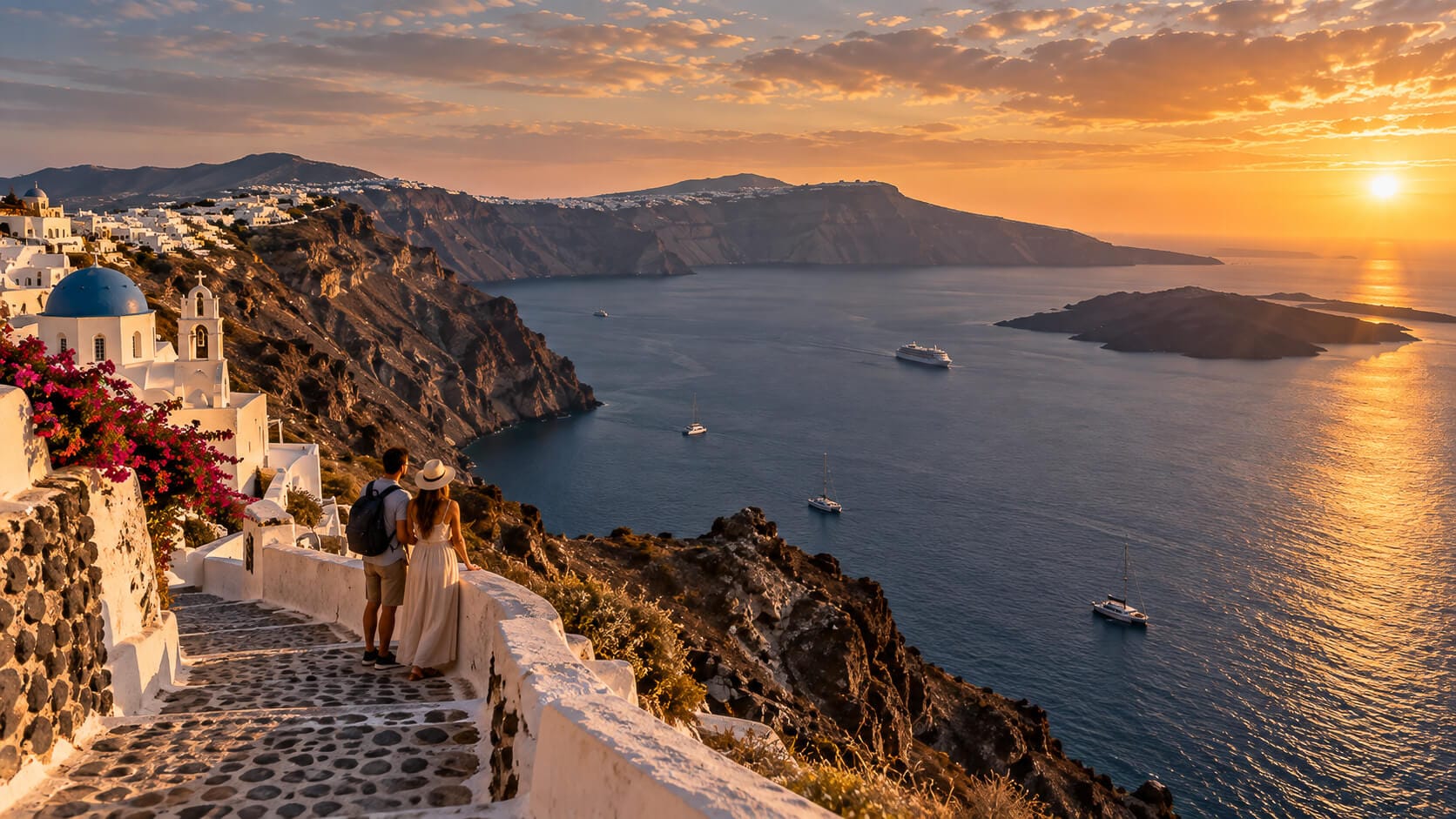
At the same time, the popular story of Santorini is often too simple: “there was one large volcanic island, the Minoan eruption happened, and today’s caldera appeared.” Geological research reveals a much longer and more complex history.
Four generations of Santorini calderas
Smithsonian Global Volcanism Program describes Santorini as a system containing at least four partly overlapping calderas. An older southern structure is associated with events around 180,000 years ago, the Skaros caldera with about 70,000 years ago, Cape Riva with about 21,000 years ago, and the youngest major caldera with the Minoan eruption roughly 3,600 years ago.
IUGS notes that during approximately 350,000 years Santorini experienced twelve major Plinian eruptions, at least four of which were associated with caldera collapse.
This means that the modern landscape of Santorini is the result of repeated cycles of volcanic growth, eruptions, collapse, erosion and later rebuilding of the system. It is not the remnant of a single event.
How large is the Santorini caldera?
Two very similar measurements appear in reliable sources. Smithsonian GVP gives approximately 7.5 × 11 km, while IUGS gives roughly 8 × 11 km.
There is no need to choose one value and present it as the only correct measurement. Santorini is a complex, multi-stage volcanic system, and the way the caldera boundaries are interpreted can affect the result. The most transparent approach is to show both values together with their sources.
Below you can watch my own footage from Santorini. On location, the scale of the caldera is much easier to understand than from a single photograph.
On the island, the scale of the entire system becomes much clearer: Fira, Imerovigli, Oia, Therasia, Aspronisi and the Kameni islands are all parts of the landscape surrounding or occupying a much larger volcanic structure.
What did Santorini look like before the Minoan eruption?
One of the important conclusions from research published in Scientific Reports is that a caldera already existed before the Minoan eruption. The Late Bronze Age landscape included a shallow, partly flooded structure inherited from earlier phases of volcanic activity, including the Cape Riva eruption.
This means that the Minoan eruption did not carve the entire modern caldera out of a complete, untouched island dominated by one central cone. Older collapse structures and remnants of the previous volcanic system were already present.
It is a good example of how geological research can change popular reconstructions of ancient landscapes. At Santorini, it is especially important to distinguish the structures produced during the Minoan eruption from those that are much older.
What did the Minoan eruption change?
The Minoan eruption was one of the key events in the history of Santorini and substantially reshaped the pre-existing volcanic system. Research indicates that the principal collapse associated with the youngest major caldera occurred during a late stage of the eruption.
The eruptive sequence includes material from the eruption column, deposits associated with intense interaction between water and the volcanic system, and pyroclastic-flow deposits. It was a multi-stage process rather than a single explosion.
So the most accurate answer to the question “Did the Minoan eruption create the Santorini caldera?” is that it formed the youngest major caldera and profoundly reshaped the landscape, but older calderas already existed.
Akrotiri — the town buried by the Santorini eruption
Akrotiri is one of the most important archaeological sites in the Aegean and a place closely connected with the history of the Santorini eruption. The settlement developed over thousands of years and formed part of a network of contacts that included Crete, Egypt and the eastern Mediterranean.
The Greek Ministry of Culture describes the settlement as having been destroyed and buried by the eruption of Thera in the 17th century BCE. Smithsonian materials use somewhat different chronological approximations. Rather than implying false precision, it is safer to refer to the 17th–16th centuries BCE and acknowledge the continuing chronological debate.
Systematic excavations began in 1967. Today, the exposed remains of Akrotiri can be visited beneath a large protective roof. It is an exceptional place where geology, archaeology and the travel history of Santorini come together.
Is the volcano inside the Santorini caldera still active?
Yes — volcanic activity at Santorini did not end with the Minoan eruption. Younger volcanic centres, including Nea Kameni and Palea Kameni, subsequently developed within the flooded caldera.
Smithsonian documents historical eruptions from these younger centres through 1950. Santorini is therefore an excellent example of how volcanic activity can rebuild within a large caldera after the original collapse.
The word “caldera” should therefore not be treated as a label for a dead volcanic feature. A caldera describes the structure and history of a volcanic system, not automatically its present level of activity.
Where are the best places to see the Santorini caldera?
Fira offers an excellent view over the central part of the flooded caldera and the Kameni islands. Imerovigli gives a broader perspective over the steep caldera walls and the Skaros area, while Oia provides good views across the northern part of the system towards Therasia.
A cruise provides a completely different perspective. From sea level, the enormous rock sections forming the caldera walls are much easier to appreciate. Their layers record successive eruptive phases, quieter periods and repeated rebuilding of the island.
If you are interested in more than a sunset photograph and want to understand the geology of Santorini, it is worth viewing the caldera from several locations. No single viewpoint reveals the full scale of the system.
Santorini caldera cruise — what can you see from the sea?
A Santorini caldera cruise is more than a way to see the cliffs or watch the sunset. From sea level, you get a much clearer sense of the height of the caldera walls, the successive rock layers and the relationship between Thera, Therasia, Aspronisi, Nea Kameni and Palea Kameni.
If you only look at Santorini from Fira or Oia, it is easy to focus on the towns perched along the rim. The view from the water makes it much easier to understand that you are inside an enormous, multi-stage volcanic system. This is one reason why first-hand observation and my own footage from the island are particularly useful here.
Do all calderas look the same?
Definitely not. This is probably the most important conclusion from comparing Santorini, Toba, Yellowstone, Ngorongoro, Taupō, Campi Flegrei, Crater Lake and Askja.
A caldera may have steep, clearly visible walls, but it may also form such an enormous depression that its boundaries are almost impossible to recognise from ground level. It can be flooded, filled with sediment and younger lava, or partly covered by a glacier.
Younger craters, cones, domes, lakes and even additional calderas can develop inside an older caldera. The modern landscape may therefore be far more complicated than the original collapse depression.
How can you recognise a caldera in the landscape?
With a small crater, visual intuition is usually enough: you can see the rim and the depression. In a structure tens of kilometres across, however, you may be standing near its centre without being able to see the opposite side.
For large calderas, topographic and geological maps, satellite imagery and panoramas from high viewpoints are therefore extremely useful. Yellowstone and Campi Flegrei are good examples of places where the full shape of the structure is much easier to recognise on a map than from a road or trail.
Santorini works almost the opposite way: the high walls surrounding the flooded basin are so dramatic that the overall caldera geometry is easier to visualise. Ngorongoro has likewise retained a very clear, enclosed form.
Calderas in Iceland — Askja, Krafla and systems beneath glaciers
Iceland is particularly interesting from the perspective of calderas because its volcanism combines fissure activity, rifting, basaltic volcanic systems and major ice caps.
Askja is one of the clearest examples for travellers: several overlapping calderas, Öskjuvatn and Víti create an exceptionally readable volcanic landscape. Krafla also contains a caldera and an extensive fissure system, while nearby Hverir provides an accessible view of the region’s geothermal activity.
Other Icelandic systems, including Grímsvötn, Bárðarbunga and Katla, show another variation: large caldera structures associated with areas covered by ice. Their landscapes cannot be interpreted in the same way as the sea-flooded caldera of Santorini.
If you want to see a landscape connected with the Katla volcanic system from a traveller’s perspective, take a look at my route through Katla Geopark and Kerlingardalsvegur. Here volcanic geology is directly connected with glaciers, extensive deposits and the landscape of South Iceland.
You can find more Icelandic landscapes in the other OndaTravel guides to Iceland. A separate guide to Iceland’s volcanoes will cover the country’s volcanic systems, their number, maps and practical safety considerations; this article remains focused specifically on the concept of a caldera.
Volcanoes and Iceland — related guides
If you want to move from the definition of a caldera to real places and modern volcanism, these OndaTravel guides are a good next step.
REYKJANES · ERUPTIONS
Volcanism in Iceland
Fagradalsfjall and Grindavík — eruptions on Reykjanes
See a modern example of Icelandic fissure volcanism, the recent eruptive history and locations connected with the active Reykjanes Peninsula.
See the Reykjanes eruptions
REYKJANES
Regional guide
Reykjanes Peninsula — volcanoes, geothermal areas and landscapes
Explore lava fields, geothermal areas, active volcanism and places worth seeing across the Reykjanes Peninsula.
Explore Reykjanes
INSIDE A VOLCANO
Iceland · Reykjanes
Þríhnúkagígur — a volcano you can descend into
See an extraordinary Icelandic volcano from the inside and compare its volcanic conduit with much larger caldera structures.
See Þríhnúkagígur
KATLA GEOPARK
South Iceland
Kerlingardalsvegur and Katla Geopark
A route through landscapes shaped by the Katla volcanic system, glaciers, volcanic deposits and the geology of South Iceland.
See Katla GeoparkFrequently asked questions about calderas
What is a caldera?
A caldera is a large volcanic depression formed primarily when part of a volcanic system collapses after a substantial amount of magma has been erupted, withdrawn or displaced.
How does a volcanic caldera form?
When a substantial amount of magma leaves part of a volcanic system, the rocks above can lose support. Faults develop and part of the surface subsides or collapses, producing a broad depression.
How large can a caldera be?
The USGS gives a typical diameter range of about 2–50 km, but size alone is not enough for classification. The formation mechanism and relationship to the wider volcanic system also matter.
What is the difference between a caldera and a crater?
A crater is usually a smaller feature directly associated with a vent or eruption site. A caldera involves a much larger part of the volcanic system and is primarily associated with collapse.
Does a caldera always form after a major explosion?
No. Non-explosive calderas also exist, including on shield volcanoes, where collapse may be related to magma drainage during lava eruptions or magma movement within the volcanic system.
Is a caldera a volcano or a landform?
The term is used in both contexts. A caldera is primarily a collapse landform related to volcanism, but it may also become the dominant feature of an entire volcanic system.
Is every caldera a supervolcano?
No. Caldera and supervolcano are not synonyms. The USGS defines a supereruption by the eruption of more than 1,000 km³ of material, while calderas occur in volcanic systems with very different sizes and eruption styles.
Can a caldera be filled with water?
Yes. Examples include Toba, Taupō, Crater Lake and Öskjuvatn. Santorini is an example of a caldera system that is partly flooded by the sea.
What is the largest caldera in the world?
It depends on the criterion. Smithsonian describes Toba, about 35 × 100 km, as the largest Quaternary caldera, while UNESCO describes Ngorongoro as the largest unbroken caldera in the world.
What are some of the most famous calderas in the world?
Well-known examples include Toba, Yellowstone, Ngorongoro, Taupō, Campi Flegrei, Crater Lake, Askja and Santorini.
Is Santorini a caldera?
Santorini is a complex volcanic system containing at least four partly overlapping calderas that formed during different stages of its geological history.
How large is the Santorini caldera?
Smithsonian Global Volcanism Program gives approximately 7.5 × 11 km, while IUGS gives about 8 × 11 km. The difference partly reflects how the boundaries of this complex structure are interpreted.
Did the Minoan eruption create the entire Santorini caldera?
No. Older caldera structures already existed. The Minoan eruption formed the youngest major caldera and profoundly reshaped the pre-existing landscape.
Is there still an active volcano inside the Santorini caldera?
Yes. Younger volcanic centres including Nea Kameni and Palea Kameni developed inside the caldera after the Minoan eruption, and historical eruptions continued into modern times.
Was Akrotiri destroyed by the Santorini eruption?
Yes. Prehistoric Akrotiri was buried during the major Bronze Age eruption of Thera. The exact chronology remains debated, so the 17th–16th centuries BCE is a cautious way to describe the dating range.
Are there calderas in Iceland?
Yes. Icelandic volcanic systems containing calderas include Askja, Krafla, Grímsvötn, Bárðarbunga and Katla. Some Icelandic calderas lie beneath glaciers.
Sources and further reading
Where do these figures come from?
The dimensions, dates and classifications used in this article are based primarily on institutional and primary sources, including the USGS, National Park Service, Smithsonian Global Volcanism Program, IUGS, UNESCO, INGV and scientific publications. Where two institutions use different criteria or provide slightly different values — such as the dimensions of the Santorini caldera or the question of the world’s largest caldera — I show both interpretations rather than choosing one without explanation.
For measurements, definitions and geological history, I rely primarily on institutional sources and scientific publications. Where sources differ — for example in the dimensions of Santorini or the meaning of “largest caldera” — I preserve the different criteria rather than selecting one number without context.
- USGS — Caldera or crater: what is the difference?
- USGS — What is a supervolcano? What is a supereruption?
- USGS Volcano Hazards Program — Glossary
- National Park Service — Calderas
- National Park Service — Nonexplosive Calderas
- USGS — Resurgent Dome in Long Valley Caldera
- Smithsonian Global Volcanism Program — Toba
- USGS Yellowstone Volcano Observatory — Yellowstone Caldera
- UNESCO — Ngorongoro Conservation Area
- Smithsonian Global Volcanism Program — Taupō
- INGV — Campi Flegrei
- National Park Service — Mount Mazama and Crater Lake geology
- Smithsonian Global Volcanism Program — Askja
- Smithsonian Global Volcanism Program — Santorini
- IUGS Geoheritage — The Quaternary Santorini Caldera
- Scientific Reports — reconstruction of pre-Minoan Santorini
- Greek Ministry of Culture — Archaeological Site of Akrotiri
Editorial note: geological terminology and classifications can vary between institutions depending on the criteria being used. Where sources apply different definitions or measurements, I show that difference rather than artificially hiding it.

About the author of OndaTravel.pl
Krystian — OndaTravel guide, photographer and filmmaker
Meet the author of OndaTravel.pl and see how the travel guides, photographs and films are created, with first-hand experience from Iceland, Lofoten and Norway.

Sorry, the comment form is closed at this time.