Nepal Floods 2026: Rasuwa, Gorkha and the latest verified information
NEPAL • RASUWA • ANSWER IN BRIEF
Nepal Flood 2026 — what happened in Rasuwa?
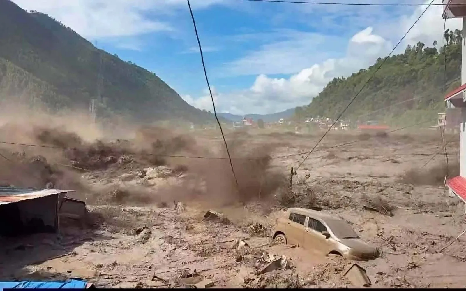
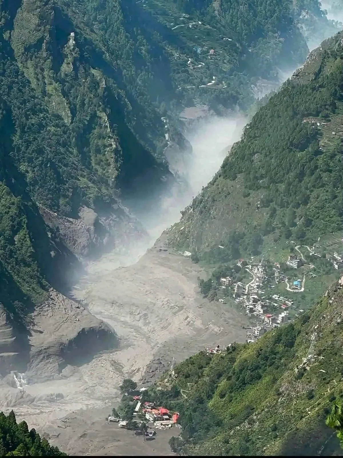
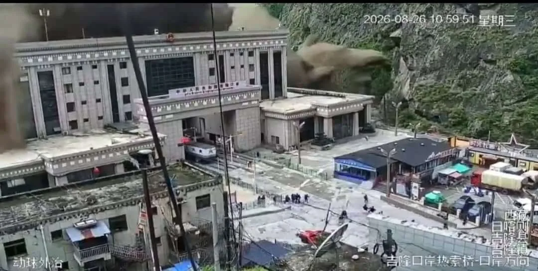
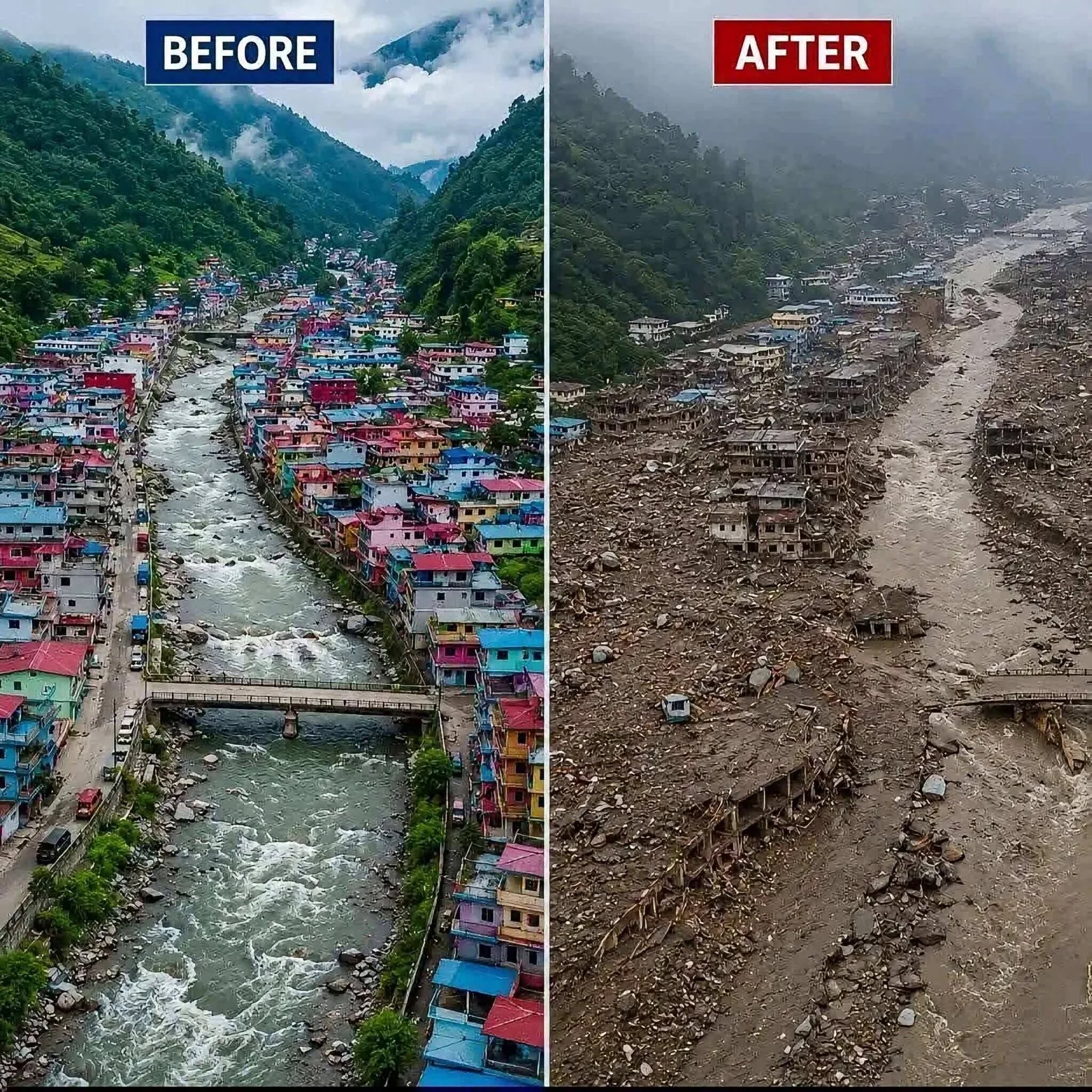
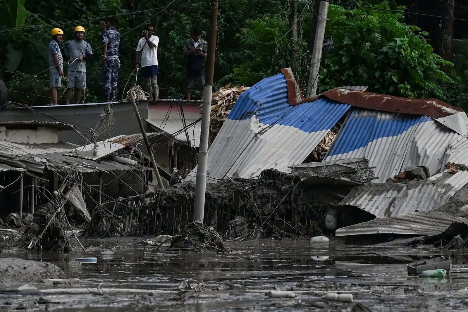
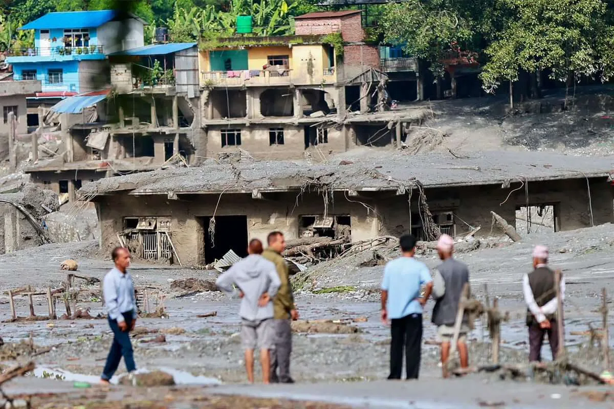
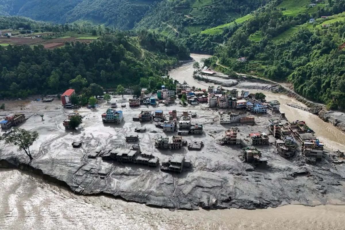
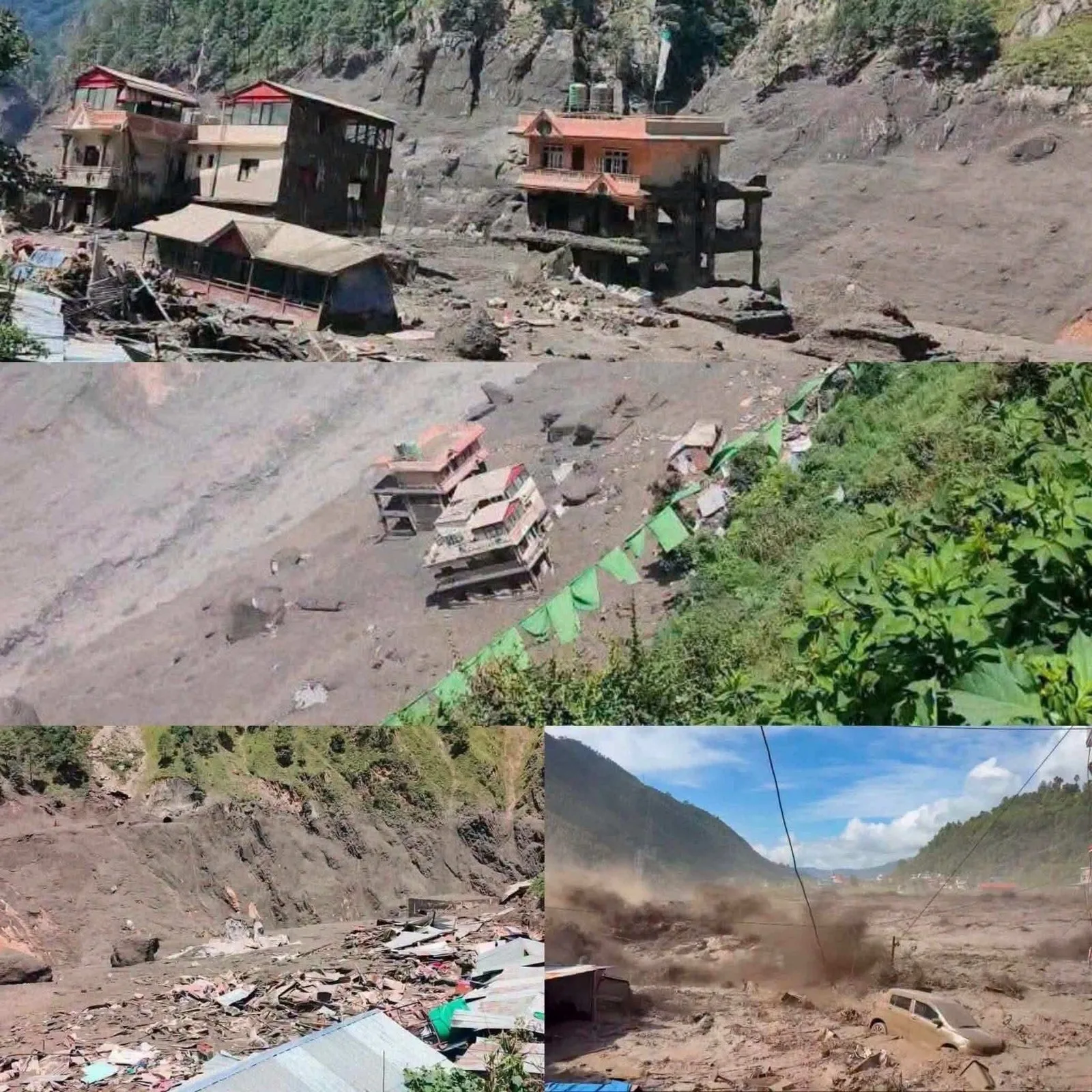
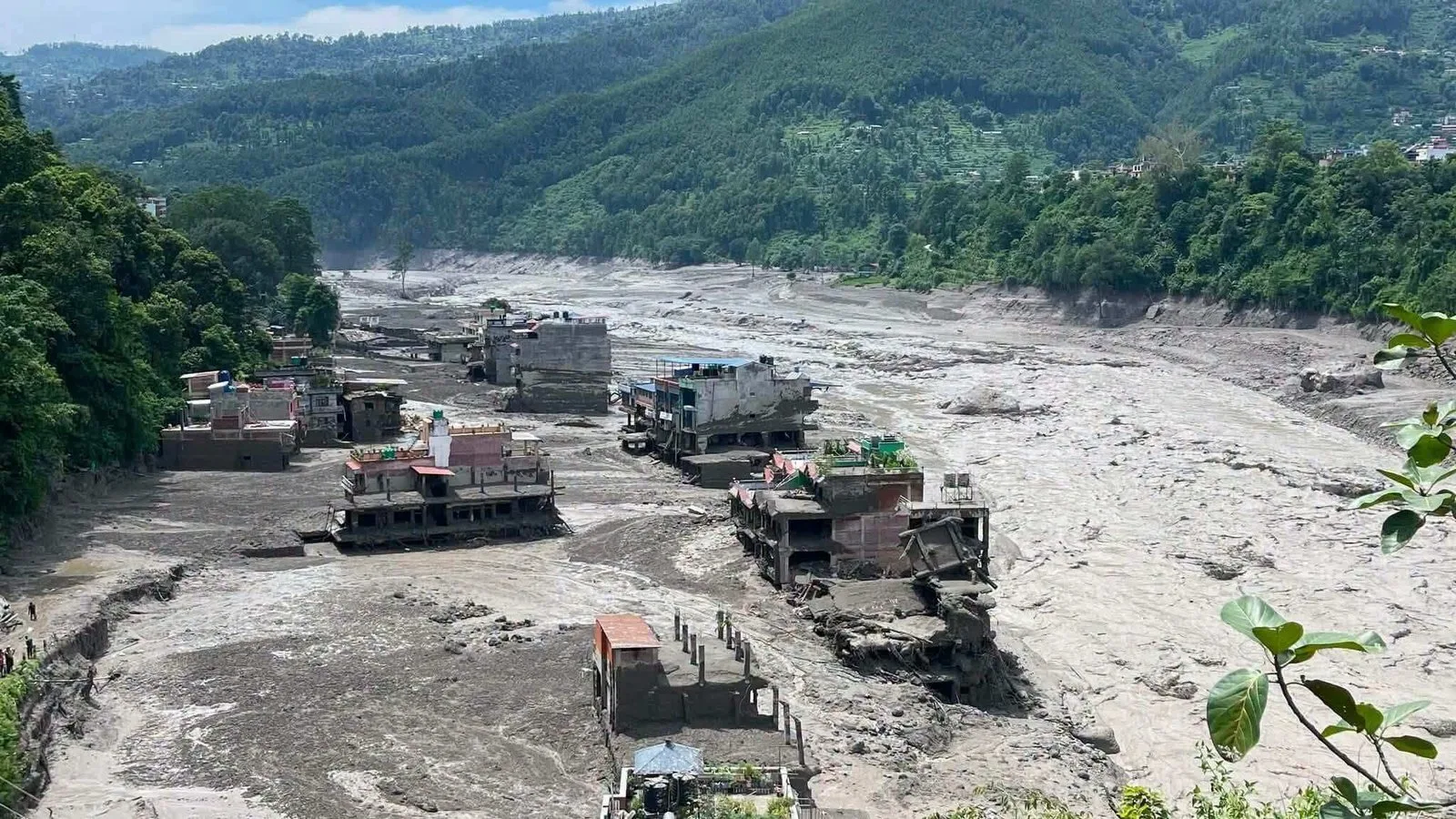
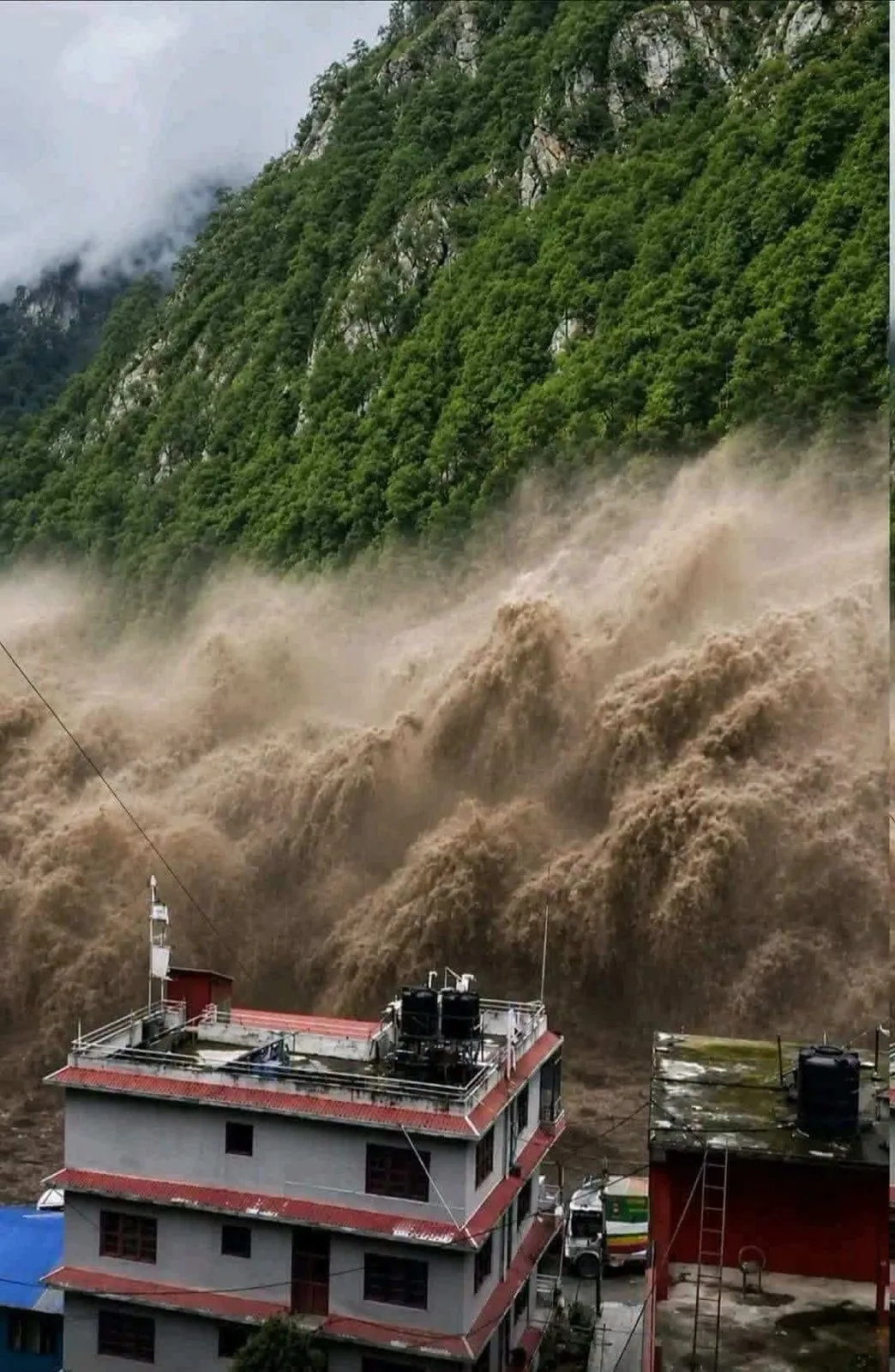
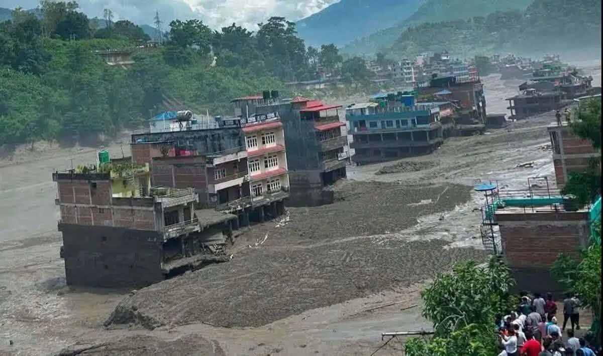
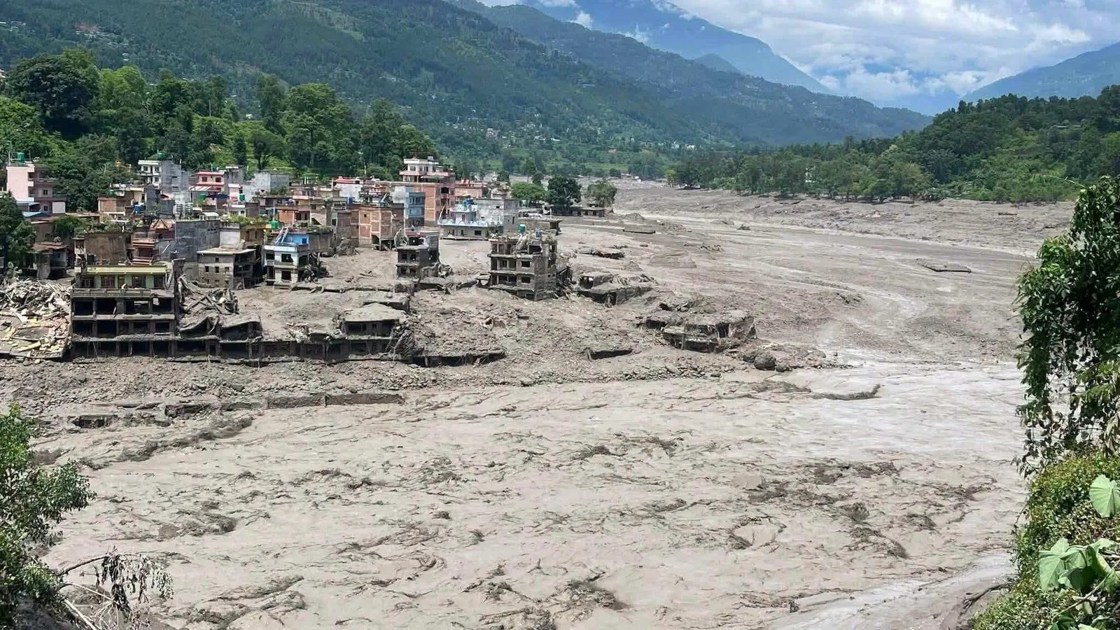
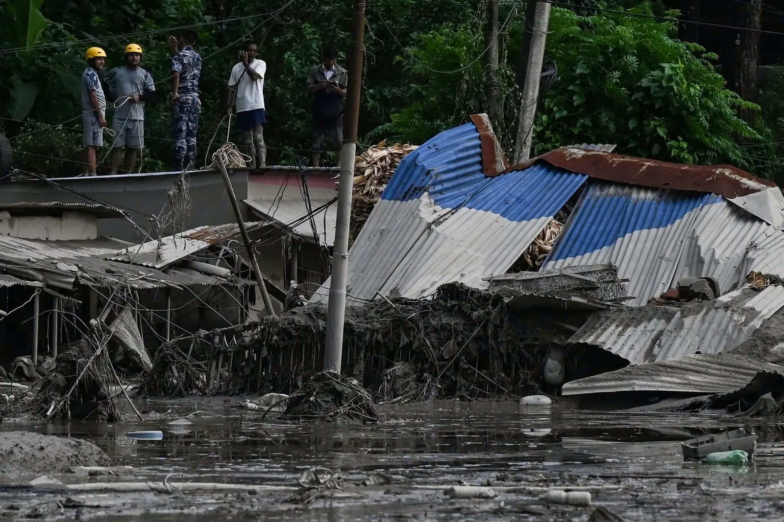
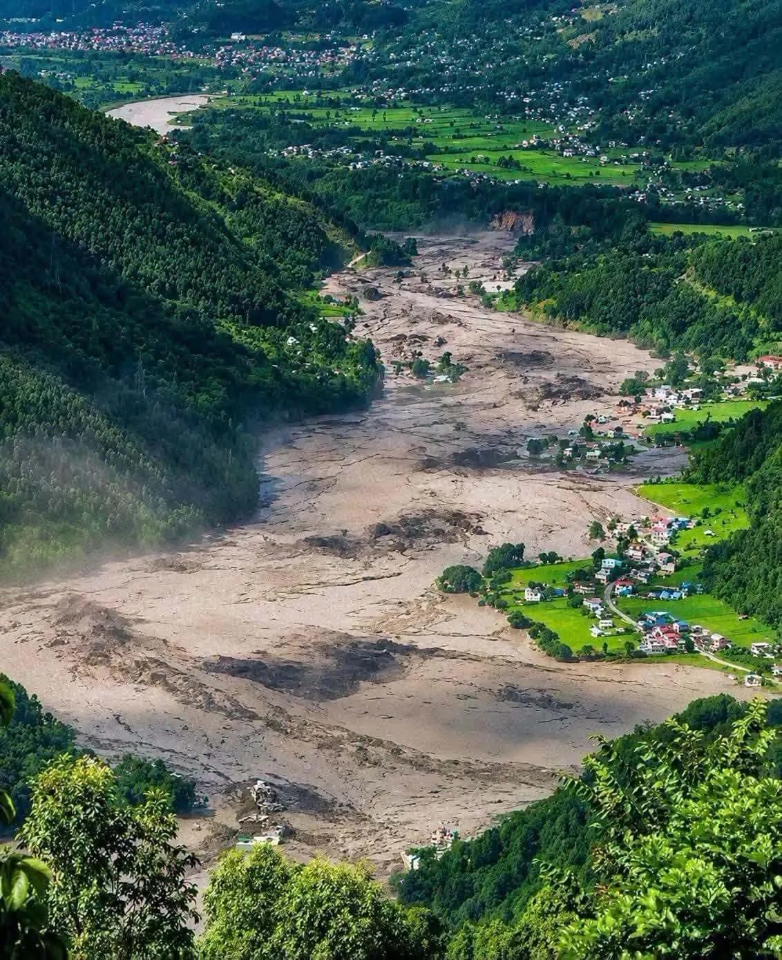
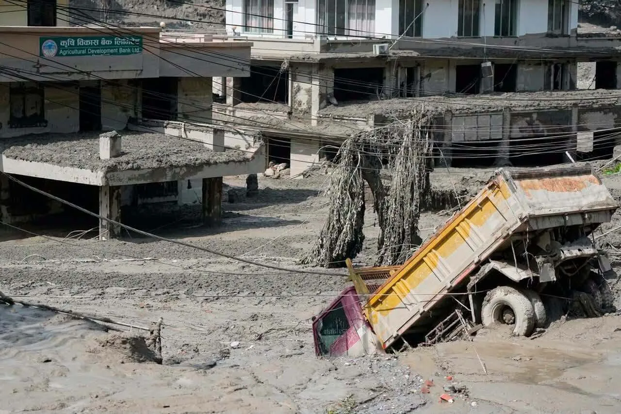
On the morning of 26 August 2026, a violent surge of water, mud, rocks and sediment swept through the valleys of Rasuwa. The most likely mechanism involves a collapse of ice and rock high in the Himalaya, the entry of material into the Lhende Khola / Bhote Koshi system and a destructive debris-laden flood wave. The exact mechanism is still being analysed, so the disaster should not yet be described as an ordinary rain flood, a confirmed classic GLOF, or an earthquake as a proven cause.
Nepal Flood 2026 – latest information
UPDATE — 11 October 2026. A separate new flood has affected the Budhi Gandaki river in Gorkha district. It is not another wave of the Rasuwa disaster and it is not a confirmed GLOF. This update keeps the two incidents, their mechanisms and their tallies separate.
A separate new event: Budhi Gandaki in Gorkha
| Scope | Verified update | Source |
|---|---|---|
| Where? | Upper Budhi Gandaki in Gorkha, around Tumche/Chumchure — outside Rasuwa and Langtang. | Source |
| What is the preliminary mechanism? | The Flood Forecasting Division said a landslide blocked a watercourse and the blockage then failed. Initial reporting did not identify heavy rain as the direct trigger. | Source |
| First confirmed situation | At least 5 people were missing and 49 were rescued; homes, bridges and infrastructure were damaged. These are preliminary 11 October figures. | Source |
| What should not be inferred? | Budhi Gandaki later joins the Trishuli system, but that alone does not establish a new impact in Rasuwa. The tallies must not be added together. | Source |
Rasuwa remains the separate 26 August disaster. NDRRMA reporting compiled as of 26 September listed 1,453 deaths, 5,285 missing people and 13,795 rescued. That tally concerns Rasuwa and other affected areas; it does not include the 11 October Gorkha flood.
Travel note: this does not make all of Nepal inaccessible. Before travel to the Rasuwa–Rasuwagadhi–Syabrubesi corridor or the Budhi Gandaki/Gorkha area, confirm roads, local notices and route conditions separately. Landslides and sudden river rises can cut access quickly during and after the monsoon.
Sources for the 11 October update: Associated Press, Flood Forecasting Division reporting via Ratopati, NDRRMA reports compiled by NSET, and current FCDO travel advice.
OndaTravel does not treat this section as an automatic counter. Figures are updated manually after new reports are checked.

Check out my YouTube channel and travel with me.
Follow the channel for videos, routes and practical travel inspiration.
Follow me here:
What’s up?
Enjoying my content?
Buy me a coffee at buycoffee.to/ondatravel and support the creation of more travel content.
Your support helps me create more practical guides, videos and travel inspiration.

Check out my YouTube channel and travel with me.
Follow the channel for videos, routes and practical travel inspiration.
Follow me here:
What’s up?
Enjoying my content?
Buy me a coffee at buycoffee.to/ondatravel and support the creation of more travel content.
Your support helps me create more practical guides, videos and travel inspiration.
What happened on 26 August 2026?
The first reports of a sudden surge appeared around 9:00 in the morning local time in Nepal. The wave did not behave like an ordinary river rising gradually. In the narrow Himalayan valley, a dense mixture of water, mud, boulders and rock material moved downstream.
A preliminary report from Nepalese hydrological services indicates that information about a large wave entering the Bhotekoshi was received at around 9:05. The surge then moved into the Trishuli and further down the larger river system.
The disaster struck an exceptionally sensitive transport corridor. Timure and Rasuwagadhi lie near the border with Tibet, while Syabrubesi is one of the most important access points for the Langtang region. The same valley is a trade route, a tourist route and an area of hydropower infrastructure.
What caused the disaster in Rasuwa?
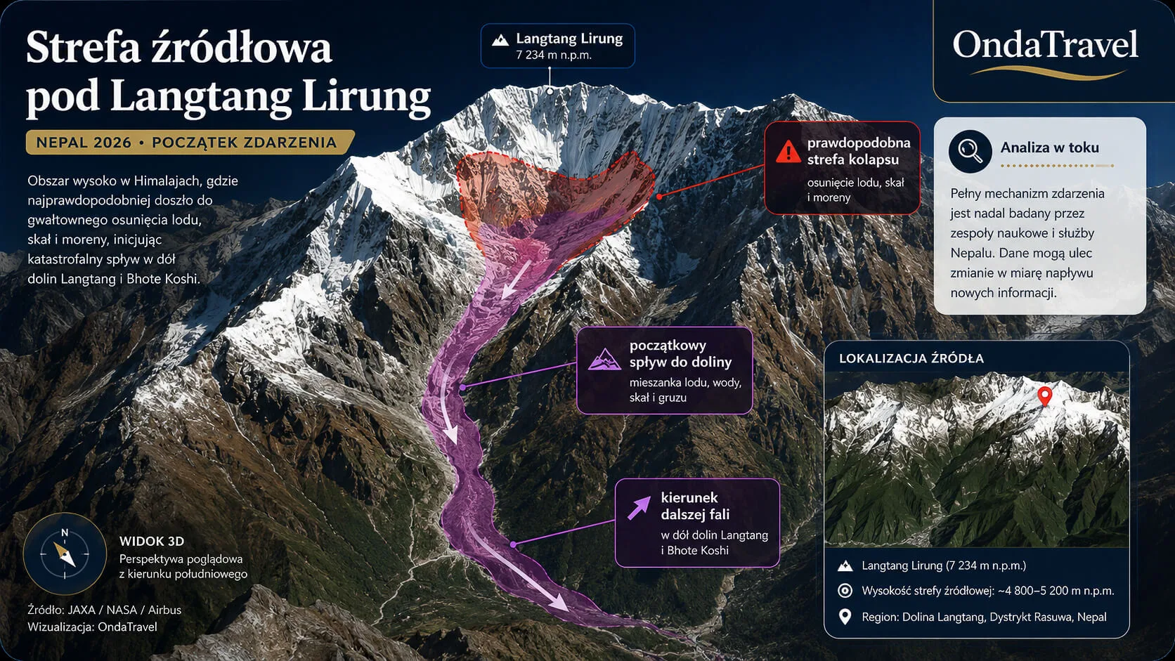
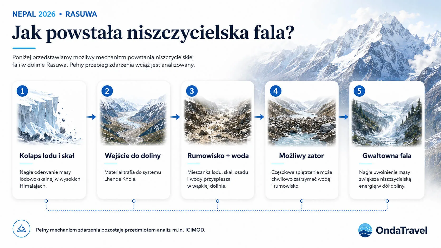
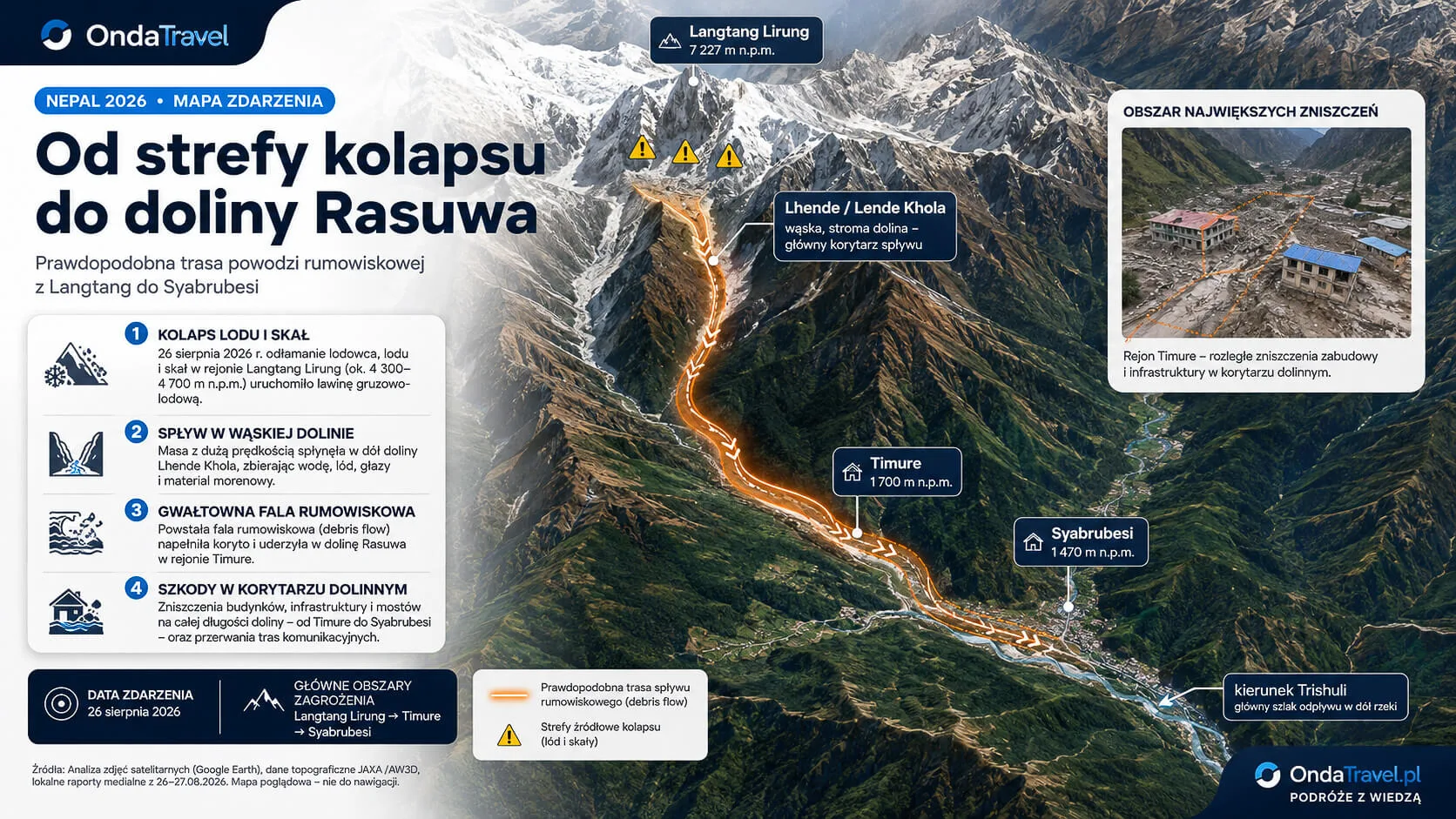
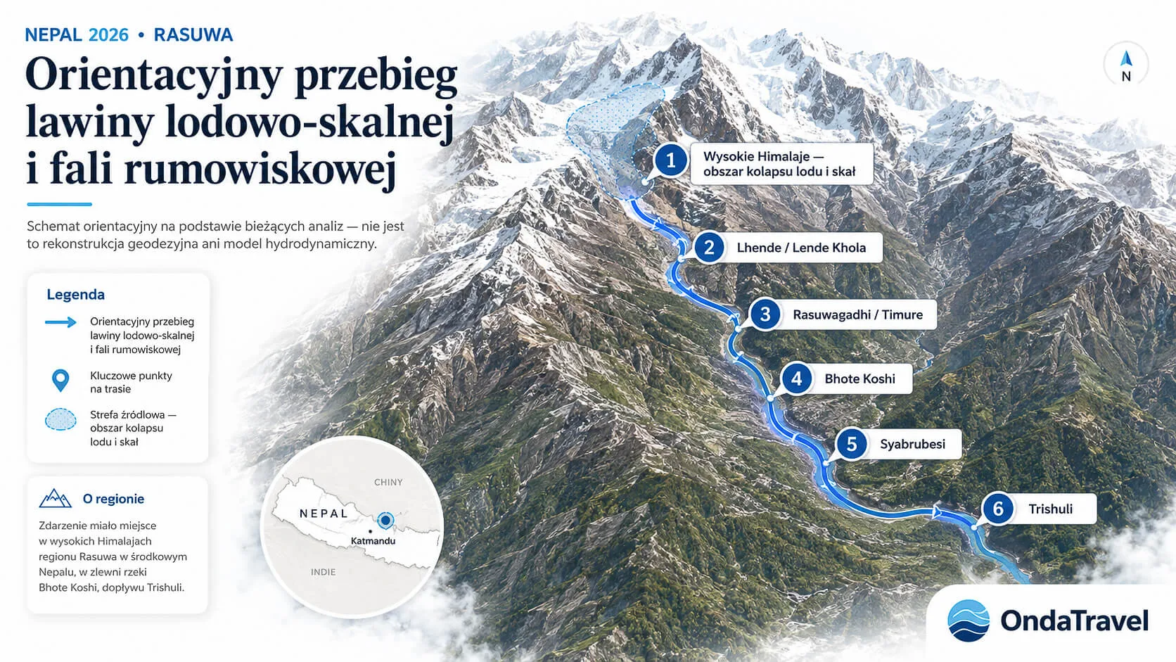
The most likely scenario currently begins high in the Himalaya. According to preliminary assessments, a huge mass of ice and rock detached from a high mountain slope and moved toward Lhende Khola, a tributary of the Bhote Koshi.
Such material can act like a moving dam. If debris blocks a narrow channel for a short time, water begins to collect behind the obstruction. When the blockage loses stability, the normal river flow is joined by a sudden release of water, mud, sediment and large boulders. The resulting wave can be far more destructive than high water alone.
That is why ICIMOD is analysing not only the collapse area but also the possibility of a temporary landslide dam. The institute stresses that the exact trigger remains unconfirmed and requires more hydrological, seismic, satellite and field data.
Ice and rock collapse – what does “ice-rock avalanche” mean?
An ice-rock avalanche is the rapid movement of a huge mass of ice, rock and debris down a very steep slope. In high mountains it can reach great speed, hit the valley floor, enter a river and turn into a multi-phase debris flow.
In the Rasuwa case, this second stage is crucial. The disaster did not end at the point of detachment. Energy was transferred into the river system and carried destruction far downstream.
Why was the wave so destructive?
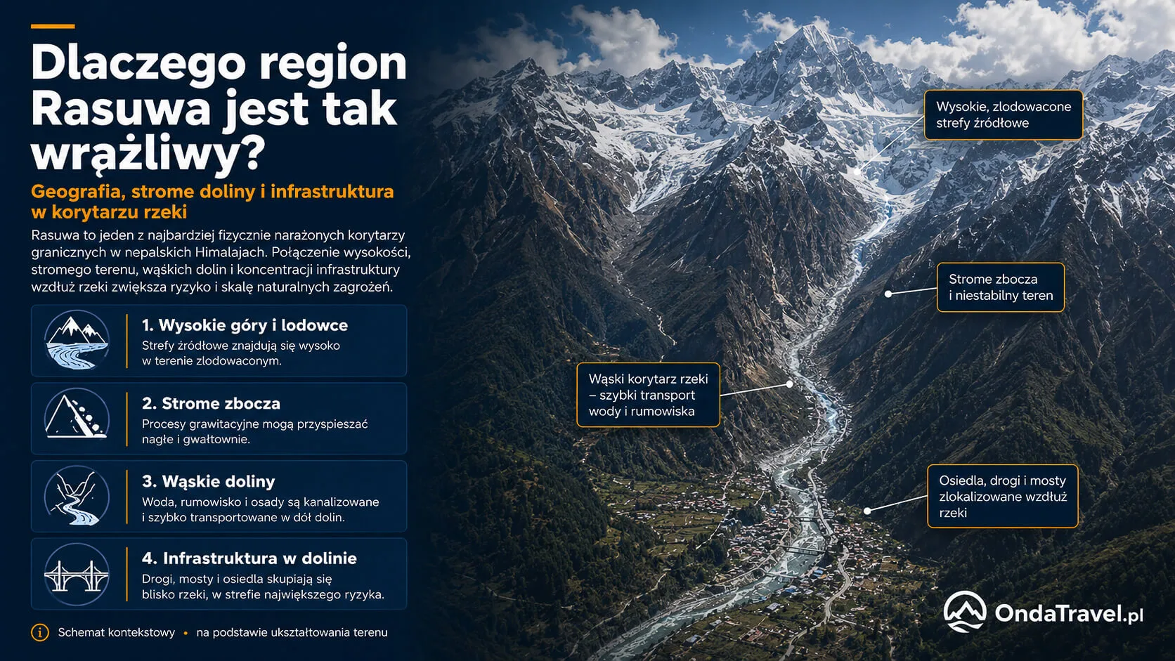
Himalayan valleys are narrow, steep and marked by huge elevation differences. This helps flows accelerate quickly. When boulders, rocks and sediment mix with the water, the mixture can behave like a dense debris stream, hitting bridges, buildings and roads with enormous force.
ICIMOD reported that on the Trishuli at Galchhi, the water level may have risen by around 9 metres in 30 minutes, and at Malekhu by around 7 metres in a similar period. Some measuring stations were damaged or completely washed away.
Was there an earthquake in Nepal?
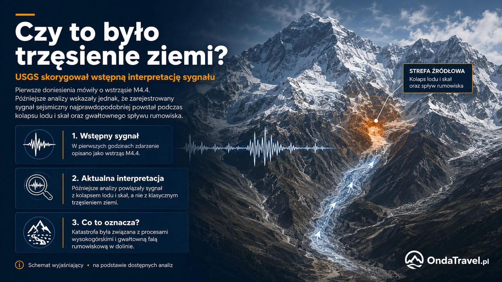
An earthquake should not be presented as the confirmed cause of the disaster.
The first automatic seismic reading was interpreted as a tremor of about magnitude 4.4. As more data arrived, another interpretation emerged. Associated Press, citing USGS, reported that the signal corresponded to the energy of an ice and rock collapse, not to a classic earthquake.
This is an important correction, because some early media reports built a simple chain: “earthquake → avalanche → flood”. The current state of knowledge does not allow that scenario to be described as confirmed.
Early reports after the Rasuwa disaster also raised questions about a possible link with seismic activity. A single tremor, however, is not enough to establish the cause of a catastrophic wave. To check the current situation, see the live earthquake map and compare the time of the event, magnitude, depth and epicentre location with USGS and local authority notices.
LIVE TRAVEL TOOLS
Check live conditions before you travel
Real-time tools for monitoring weather, natural phenomena and travel safety.
Was the Nepal disaster a GLOF?
There is not yet a basis for calling it a classic GLOF with certainty.
GLOF, or Glacial Lake Outburst Flood, is a sudden flood caused by the breach or drainage of a glacial lake. Such events are well known in the Himalaya and can cause severe damage tens of kilometres from the source.
In Rasuwa, however, the main scenario under investigation is an ice-rock avalanche that entered Lhende Khola and may have formed a temporary blockage. If later analyses show the involvement of a pre-existing glacial lake, the classification may change. At this stage, the most precise terms are flash flood, debris flood, collapse of ice and rock, and ice-rock avalanche.
Could another flood wave hit Nepal?
The hazard does not end when the main flood wave falls. Nepalese authorities still consider the China-border terrain unstable and vulnerable to further landslides and cascading events.
Nepal plans to rebuild its early-warning system. The first installation is expected at Timure and will include seismic sensors, cameras and VSAT satellite communications capable of operating when mobile networks fail.
The plan also calls for improved real-time data sharing with China on glacier movement, water levels and cross-border hazards.
- terrain above the Bhotekoshi remains geologically unstable;
- rescue teams are still working inside tunnels and underground powerhouses;
- Timure is expected to become the first site of the new seismic-camera-satellite warning network;
- reopening G216 in Tibet improves rescue access but does not mean the hazard has ended.
For travellers: Rasuwagadhi, Timure, Syabrubesi, Langtang and the Bhotekoshi–Trishuli corridor should still be treated as an active disaster zone, not normal tourism territory.
Where exactly did the disaster happen?
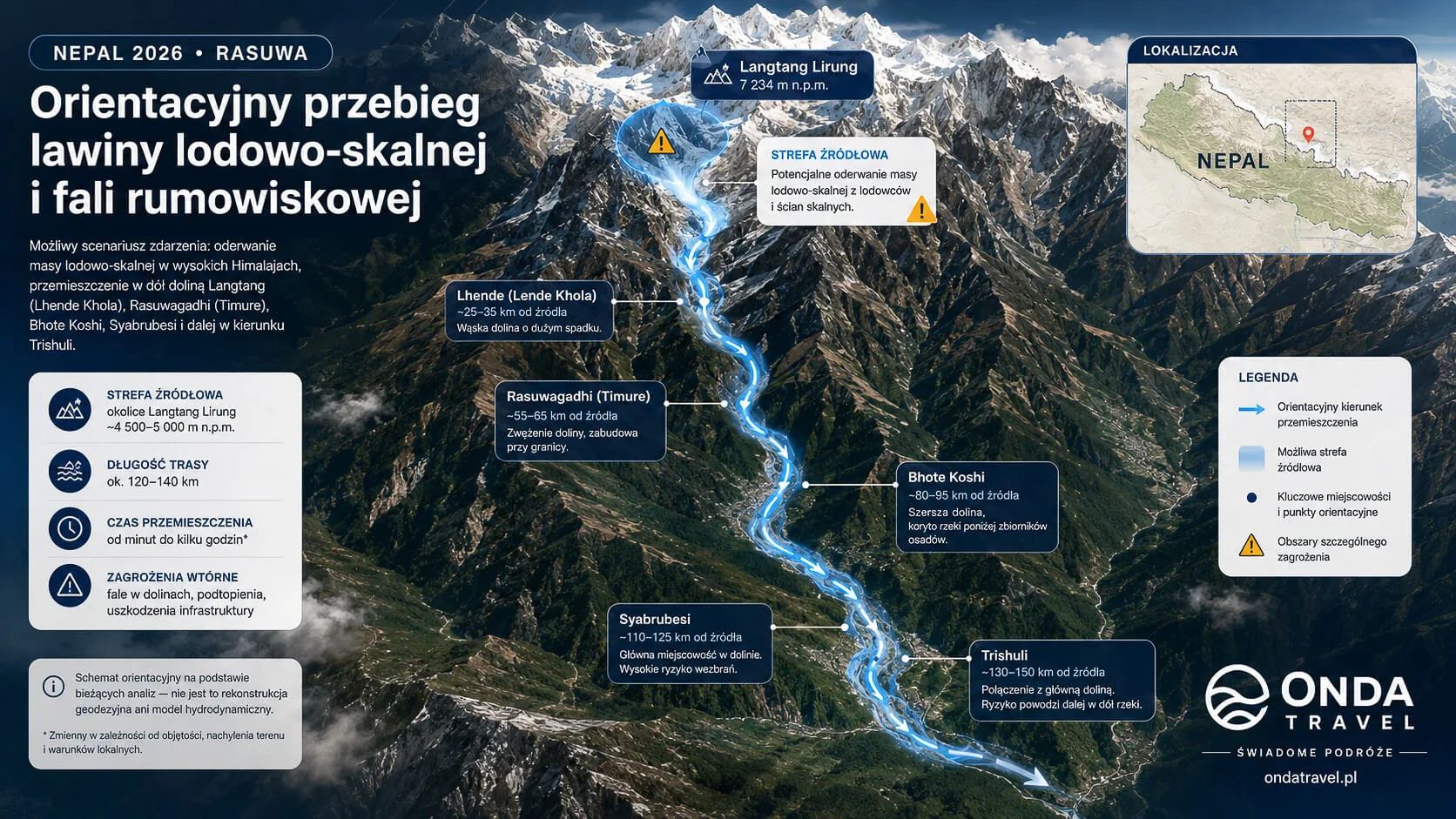
The most important disaster corridor can be described as:
high Himalaya / source area → Lhende Khola → Bhote Koshi → Rasuwagadhi / Timure → Syabrubesi → Trishuli → Nuwakot and further downstream districts.
Lhende Khola
This high-mountain tributary is where the beginning of the catastrophic sequence is being investigated. ICIMOD points to the possible entry of a huge mass of ice and rock into the channel.
Rasuwagadhi and Timure
Rasuwagadhi is the most important border point in this part of the valley. Timure lies directly on the route to the crossing. The disaster destroyed transport infrastructure and again hit an area that had already been badly damaged by a violent flood in 2025.
Syabrubesi
Syabrubesi is a key hub for people heading to Langtang. The flood damaged the settlement and road access to the northern part of the district.
Trishuli
After entering the Trishuli, the wave could move far beyond Rasuwa. That is why warnings were also directed to residents of Nuwakot, Dhading and further areas along the river.
Geographic note: Nepal has more than one river system called Bhote Koshi/Bhotekoshi. Historical disasters in the Kodari and Sun Koshi area should not automatically be presented as events in exactly the same place as the 2026 Rasuwa disaster.
Victims and missing people
The main NDRRMA tally on 2 September is 1,114 dead or recovered remains, 3,916 unaccounted for and 11,993 rescued.
Prime Minister Balendra Shah also reported 292 injured, with 182 discharged after treatment.
Nepal Police maintains a parallel register. Its 5:00 am update reported 1,127 recovered bodies and 4,858 missing. The difference should be treated as a registry discrepancy, not as two totals that can be combined.
- Rasuwagadhi: roughly 46 people may be in a potentially survivable chamber; their condition is not confirmed.
- Upper Trishuli-3A: 42 people believed trapped or missing.
- Upper Trishuli-3B: 191 unaccounted for in the newer operational tally.
- Hydropower: Kathmandu Post reports roughly 947 people currently unaccounted for across affected projects.
Missing foreign tourists
Nepal’s Foreign Ministry said on 2 September that about 590 foreign nationals from 34 countries remain unaccounted for.
This is a different register from the previous NDRRMA snapshot of 583, so it should not be interpreted as a simple 583-to-590 increase. Different agencies update their lists at different times.
More than 300 foreign nationals have been rescued. OndaTravel does not reproduce unverified lists of names; individual cases should be checked with Nepal’s Foreign Ministry, embassies or official rescue agencies.
Are Polish citizens among the missing?
In the checked public notices, we found no official confirmation that Polish citizens are among the missing.
This does not automatically mean that no Polish citizen was in the region. In disasters on this scale, nationality lists are updated gradually.
This answer will be updated only on the basis of notices from the Polish Ministry of Foreign Affairs, consular posts or official Nepalese service data.
What about Langtang after the Rasuwa flood?
Langtang is one of the places travellers ask about most often. That is natural: Syabrubesi is the basic entry point to the popular trekking valley, and the disaster seriously damaged infrastructure in this part of Rasuwa.
Nepal’s Department of Roads reported the destruction of around 42 kilometres of road from Betrawati in Nuwakot to the Rasuwagadhi crossing, as well as the loss of several concrete bridges. The route from Syabrubesi toward the border was also damaged.
At this stage, it is not possible to give a reliable date for full reopening of access to Langtang. Travellers planning a trek in September or October should check road conditions, Langtang National Park notices, Nepal Tourism Board information and confirmation from a local operator immediately before departure.
We also do not assume that the problem affects all of Nepal. The situation may be completely different in Annapurna, the Everest region or other routes, but each must be assessed separately for weather, monsoon landslides and local notices.
What about Gosaikunda?
Gosaikunda lies in Rasuwa district at an elevation of about 4,380 metres and is both an important trekking destination and a pilgrimage site. Nepal Tourism Board describes it as part of the Langtang region and a sacred Hindu site.
The fact that the lake lies high in the mountains does not automatically mean it was directly destroyed by the wave in the Bhote Koshi. For travellers, the bigger problem may be road access to Rasuwa, damaged infrastructure and the possibility of further landslides or floods during the monsoon.
That is why the question “is Gosaikunda open?” must be split into two: whether the trail itself is passable, and whether it is safe to reach its starting point. Both answers require current confirmation.
Is Nepal safe to travel now?
Do not treat the Rasuwa disaster as automatically closing all of Nepal, but do not travel to the affected area without current confirmation from authorities and a local operator.
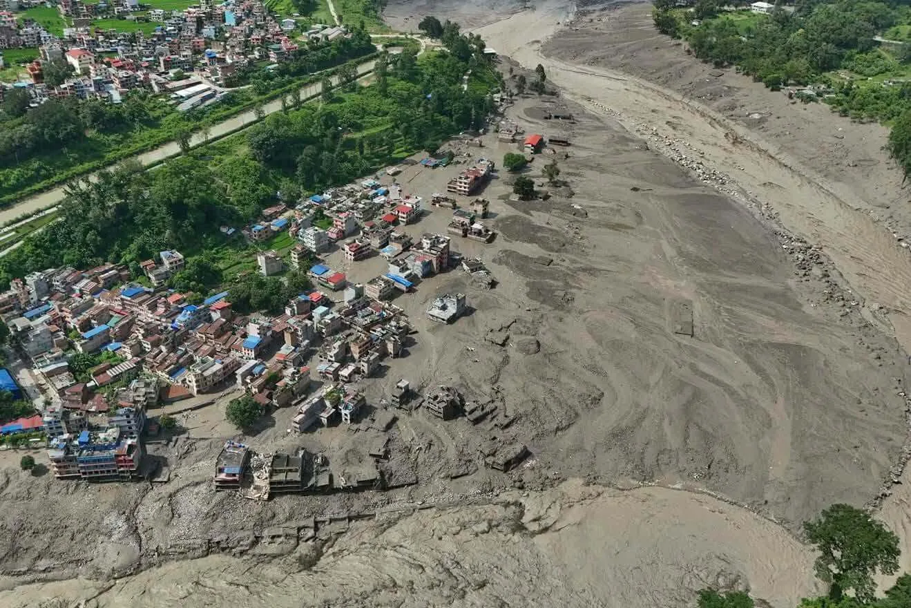
The biggest problems currently concern the Rasuwagadhi–Timure–Syabrubesi corridor and areas along the Bhote Koshi and Trishuli. Destroyed roads, bridges, communication outages and the ongoing rescue operation mean the situation can change hour by hour.
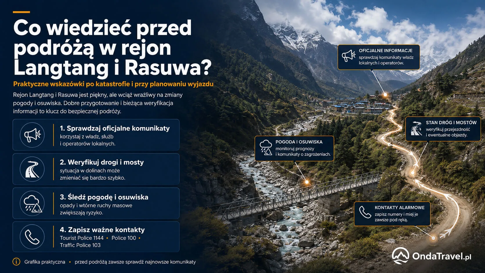
For tourists, the official channels of Nepal Tourism Board and Tourist Police are useful. Tourist Police has a post in Syafrubesi/Syabrubesi, and the tourist emergency number in Nepal is 1144, while 100 is the police number.
For travellers: the Rasuwa–Rasuwagadhi–Syabrubesi corridor requires current verification before departure. Check Nepal Tourism Board, Tourist Police and Langtang National Park notices. Nepal Tourism Board currently lists Tourist Police 1144, Police 100 and Traffic Police 103; a Tourist Police unit also operates in Syafrubesi in Rasuwa district.
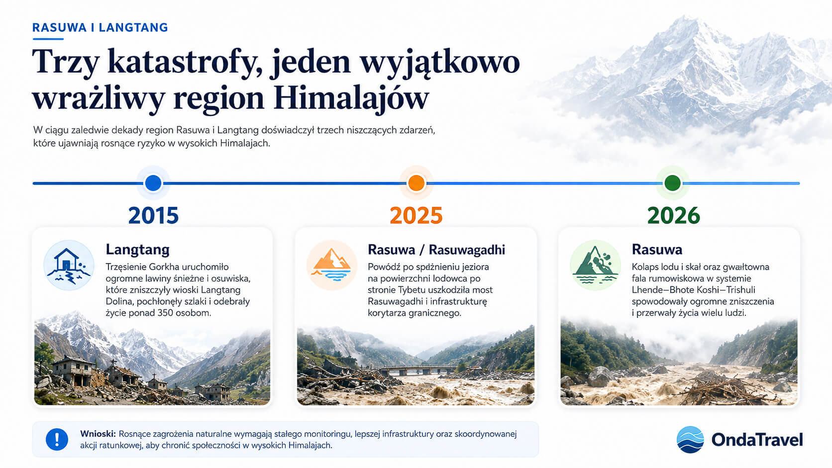
Rasuwa was hit by a similar disaster in 2025
The most worrying part of the story is that the same corridor was seriously damaged just one year earlier.
On 8 July 2025 a violent flood in the Lhende–Bhote Koshi system destroyed the Miteri/Friendship Bridge linking Nepal and China, damaged the Rasuwagadhi dry port and the road from Syabrubesi to the border.
ICIMOD satellite analysis then pointed to a sudden drainage of a supraglacial lake on a glacier on the Tibetan side, north of Langtang Himal. Reuters reported at least nine deaths, 19 missing people on the Nepal side and 11 on the Chinese side.
This is an important comparison, but the mechanisms of 2025 and 2026 should not be automatically equated. In 2025, drainage from a lake on the glacier surface was identified. In 2026, the main mechanism under investigation is a collapse of ice and rock and a possible secondary river blockage.
Langtang 2015 – an earlier major tragedy in the region
On 25 April 2015, the Gorkha earthquake of magnitude 7.8 struck Nepal. In the Langtang valley, the shaking triggered a huge avalanche of snow, ice and rock from the Langtang Lirung massif.
ICIMOD studies describe not only the avalanche itself but also a destructive air blast. The eight highest settlements in the valley were damaged or completely destroyed. Later scientific studies refer to more than 350 people dead or missing in the Langtang disaster.
The year 2015 is important for understanding Rasuwa, but it should not be suggested that the current disaster is a repeat of that event. Then, the direct trigger was a very strong earthquake. In 2026, such a link has not been confirmed.
Why is Rasuwa so exposed to disasters?
Rasuwa combines several risk factors in one place.
First, elevation differences are huge and the valleys are very steep. Material falling from slopes can reach high speed in a short time.
Second, the region is strongly linked to the cryosphere: glaciers, seasonal snow and frozen high-mountain ground. Changes in ice or rock stability can trigger processes that later enter rivers.
Third, narrow valleys leave little room for rivers and infrastructure. Roads, bridges, hydropower facilities, settlements and the border crossing are often located directly next to the channel.
Fourth, disasters are transboundary. An event can begin high on one side of the border and strike settlements on the other side very quickly. This makes warning difficult if hydrological data and observations are not shared in real time.
Did climate change cause the disaster?
At this stage, this cannot be stated.
Climate change is an important part of the wider context. ICIMOD notes that warming affects glaciers, snow, permafrost and slope stability in the Himalaya, and cryosphere-related hazards are becoming a growing regional problem.
This is not the same as proving that the specific collapse of 26 August 2026 was directly caused by climate change. Such attribution requires separate scientific analysis.
The most responsible wording is therefore: the disaster occurred in a rapidly changing high-mountain environment, where warming increases many types of hazards, but the role of climate change in this specific event has not yet been established.
Rasuwagadhi – historic corridor between Nepal and Tibet
Rasuwagadhi is not merely a small border crossing. Nepal’s customs authority describes the area as an important trade gateway between Nepal and Tibet, located about 152 kilometres north of Kathmandu.
The corridor has long been used for trade and cultural exchange, and today it is important for import and export between Nepal and China. It is also one of the routes used by pilgrims heading toward Lake Manasarovar and Mount Kailash.
Nepal Tourism Board describes Trishuli/Bhote Koshi as an old mountain route leading toward Kerung/Gyirong. This helps explain why the disaster affected local communities, transport, trade, tourism and pilgrims at the same time.
Similar glacier-related disasters in Nepal
Thame 2024
In August 2024, a GLOF struck the village of Thame in the Everest region. ICIMOD initially confirmed the breach of Thyanbo lake. Later studies showed a more complex chain: a rock avalanche hit a lake at about 4,900 metres, generated a displacement wave and led to a sudden outflow.
This is a useful example of how different high-mountain processes can combine into one catastrophic sequence.
Birendra Tal near Manaslu – 2024
In April 2024, a massive ice avalanche from the Manaslu glacier front entered Birendra Tal. The displacement wave increased the outflow and caused a sudden rise in the Budhi Gandaki.
This is again a different region of Nepal, but the mechanism shows that the entry of a large mass of ice into water can rapidly change river flow.
Cirenma Tso – 1981
On 11 July 1981, an ice avalanche struck Lake Cirenma Tso in Tibet. The resulting flood crossed into Nepal, destroying bridges and about 27 kilometres of road. ICIMOD reports more than 200 deaths.
This is not, however, the same Bhote Koshi as the Rasuwa–Trishuli system from 2026. This historical case belongs to another part of the Koshi basin and should be presented only as an example of a transboundary glacial hazard in the Himalaya.
What the disaster says about early warning
One of the most important questions after the event is not only “what triggered the wave?”, but also “could people have been warned earlier?”
Events originating high in the mountains can develop much faster than a typical monsoon flood. If a collapse of ice or rock forms a sudden blockage and then breaks it, the time between the start of the event and the impact on the first settlements can be very short.
Rasuwa also shows the problem of transboundary hazards. Effective warning requires rapid sharing of seismic, hydrological, satellite and field data between institutions on both sides of the border.
This does not mean that the disaster could certainly have been prevented. It is fair, however, to ask whether better monitoring and automatic alarms could have increased the time available for evacuation.
Sources and OndaTravel update methodology
This article is a living article. Its news section may change as new notices appear, while the sections explaining geography, history and mechanisms remain stable.
For updates, we use the following hierarchy of sources:
- primary sources: NDRRMA, Nepal Police, Nepal Tourism Board, ICIMOD, USGS, Langtang National Park and relevant state authorities;
- news agencies and media with high verification standards: Reuters and Associated Press;
- scientific and satellite sources: research publications, NASA and Copernicus;
- Reddit, X and other social media: only as sources of user questions, potential visual materials and leads for further verification.
Social media are not a basis for OndaTravel to change the official casualty toll or determine the cause of the disaster.
Every major correction should have a timestamp. If two reliable sources give different numbers, we report the discrepancy instead of arbitrarily choosing one value.
Other extreme events we cover: the M7.7 Panama earthquake, Hurricane Simon off Mexico’s Pacific coast, Hurricane Isaias in Florida and Alabama, the tornado in Marsala and Petrosino, Sicily.
Nepal Flood 2026 – frequently asked questions

TRAVEL NEWS
Is Sweden giving away islands? The real rules of the Visit Sweden contest
Is Sweden giving away islands? We check the real rules of Visit Sweden’s Your Swedish Island contest: what you can win, who can apply and what is exaggerated.
How many people died in the Nepal flood?
The Rasuwa tally depends on the report cut-off. NDRRMA reporting compiled as of 26 September listed 1,453 deaths, 5,285 missing people and 13,795 rescued. The 11 October Budhi Gandaki flood in Gorkha is a separate incident and is not included.
How many people are missing?
The 26 September Rasuwa reporting listed 5,285 missing people. Initial reports on the separate Budhi Gandaki flood in Gorkha listed at least 5 missing. These registers must not be added together.
What caused the 2026 Nepal flood?
This article now covers two distinct 2026 events. Rasuwa is associated with an ice-and-rock collapse and a possible river blockage; preliminary information for Gorkha on 11 October points to a landslide blockage that failed.
Was there an earthquake in Nepal?
The first automatic reading suggested an earthquake, but later USGS analysis described by AP indicated that the seismic signal came from ice and rock collapse. An earthquake should therefore not be presented as the confirmed cause of the disaster.
Was it a GLOF?
Neither event should be described as a confirmed GLOF. Initial information for Gorkha points to a landslide-dam failure; Rasuwa remains under analysis for an ice-and-rock collapse and a possible river blockage.
Where is Rasuwa?
Rasuwa is a mountain district in Bagmati Province, north of Kathmandu, on Nepal’s border with Tibet. It includes Rasuwagadhi, Syabrubesi and a large part of Langtang National Park.
Where is Rasuwagadhi?
Rasuwagadhi lies on Nepal’s northern border with Tibet and is an important trade crossing and route toward Gyirong/Kerung.
Was Langtang affected?
The disaster seriously damaged access to northern Rasuwa and Syabrubesi, the main entry point to Langtang. Trail availability must be checked directly before travel.
Can you travel to Gosaikunda now?
Do not decide only on the basis of earlier plans. Confirm the road condition to Rasuwa, access to the trailhead and current notices from Langtang National Park and Nepal Tourism Board.
Are Polish citizens among the missing?
In the checked public notices, we found no official confirmation regarding missing Polish citizens.
Did a similar flood happen before?
Yes. In July 2025, the same Rasuwagadhi corridor was hit by a violent flood after the sudden drainage of a supraglacial lake on the Tibetan side. The Friendship Bridge was among the structures destroyed.
Did climate change cause the disaster?
This has not been confirmed. Warming changes glaciers, snow, permafrost and slope stability in the Himalaya, but scientists have not yet determined its direct role in the event of 26 August 2026.
Is Nepal safe for tourists now?
There is no single answer for all of Nepal. Before travel to Rasuwa or the Budhi Gandaki/Gorkha area, confirm roads, route conditions and local warnings. Assess other regions separately.
Useful contacts for travellers
Tourist Police Nepal: 1144 Police assistance: 100 Traffic Police: 103
Reconfirm these numbers directly before travelling through official Nepal Tourism Board / Tourist Police channels.
LIVE TOOLS
OndaTravel maps and radars – check the situation before travelling
Go to the OndaTravel tools centre if you want to check current maps, radars and data useful for planning a trip and assessing the situation in a region.



Hi, I’m Krystian “dziadzia przewodnik” from OndaTravel.pl!
The North is my greatest passion, but the world is far too beautiful to stay in just one climate. On my blog, I combine the raw landscapes of Iceland and Norway with the exotic energy of Thailand or Vietnam, showing you how to travel authentically — with passion and a camera in hand.
What will you find on OndaTravel.pl?
Visual storytelling: As a photographer and filmmaker, I don’t just describe places — I take you there with professional photos and video.
North expert: Ready-to-use road trip plans for Iceland and Norway, smart tips for budget travel, and my original Northern Lights Radar (locations and forecast).
Travel through the lens of cinema: I track down filming locations — from icy scenes in Interstellar to tropical frames from world cinema.
New direction: Exotic destinations: I love contrast, so the blog is featuring more and more practical knowledge about Vietnam and Thailand. I’ll show you how to find your way around Southeast Asia and come back with your best memories.
P.S. follow me here


Author
Krystian „dziadzia przewodnik”The North is my greatest passion, but the world is too beautiful to stay in one climate. On my blog I combine the raw nature of Iceland and Norway with the exotic energy of Thailand and Vietnam, showing you how to travel authentically, with passion and a camera in hand.