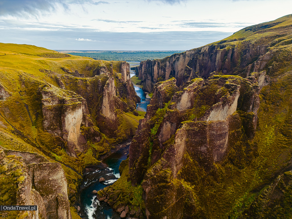
Gljufrabui vs Nauthusafoss: Two Hidden Waterfalls in Iceland — Which One to Visit?
Gljufrabui or Nauthusafoss? Compare photos, crowds, South Coast access, roads and safety before choosing between these two hidden Icelandic waterfalls.
Gljúfrabúi and Nauthúsafoss can look remarkably alike: both waterfalls are framed by narrow rocky surroundings in southern Iceland. Gljúfrabúi is close to Seljalandsfoss, while Nauthúsafoss belongs to Nauthúsagil ravine. They are not the same place, and the most useful differences concern access, current conditions, crowds and the kind of visit you want to plan. Gljúfrabúi has a documented veiling-horsetail classification, while travel guides also call Nauthúsafoss a horsetail; the evidence is not equally strong.
| Compare | Gljúfrabúi | Nauthúsafoss / Nauthúsagil |
|---|---|---|
| Location | Next to Seljalandsfoss | Farther along the road 249 corridor |
| Main attraction | A waterfall behind a rocky opening | A ravine and its hidden waterfall |
| Access | Short add-on to a famous stop | Separate planning; condition-dependent |
| Visitors | Queues reported in October 2026 | No comparable crowd statistics |
| Decision | Is it worth adding to the stop? | Do conditions support a separate visit? |
| Waterfall form in sources | Veiling horsetail (WWD); also listed as plunge elsewhere | Horsetail in travel guides; less independent evidence |
Similar photographs can hide very different travel decisions. This guide compares the sites rather than repeating a general Iceland waterfall itinerary.
The images are drawn from previously published OndaTravel photography, not from the October 2026 television news report. Always verify road and ground conditions before visiting.
Contents
- Two hidden waterfalls that look like twins
- Gljúfrabúi: the waterfall beside Seljalandsfoss
- Nauthúsafoss: a waterfall at the end of a ravine
- Are both horsetail waterfalls? Understanding veiling and plunge forms
- The geology and stories behind the rock walls
- How similar are they really?
- From hidden gem to social-media crowd: what changed in 2026?
- Roads, parking and the most important planning difference
- OndaTravel photographs: comparing the atmosphere, not just the falls
- Which waterfall should you choose for your South Coast itinerary?
- One visual resemblance, two genuinely different places
- Frequently asked questions
- Sources

Check out my YouTube channel and travel with me.
Follow the channel for videos, routes and practical travel inspiration.
Follow me here:
What’s up?
Enjoying my content?
Buy me a coffee at buycoffee.to/ondatravel and support the creation of more travel content.
Your support helps me create more practical guides, videos and travel inspiration.

Two hidden waterfalls that look like twins
Put photographs of Gljúfrabúi and Nauthúsafoss side by side and you might wonder whether they show the same place. In both, water disappears into a narrow rocky setting on Iceland’s South Coast. The cliffs frame the cascade, the light comes from above and the mist adds drama. But a similar photograph does not mean the journey, access or visitor experience will be similar.
Gljúfrabúi is a separate waterfall very close to famous Seljalandsfoss. Nauthúsafoss is associated with the Nauthúsagil ravine, farther into the landscape beneath the Eyjafjöll mountains. One fits naturally into a standard South Coast stop; the other calls for more deliberate planning and a current check of road and ground conditions.
Our guide to Iceland’s most beautiful waterfalls covers more stops and route ideas. This article tackles a narrower question: which of these two strikingly similar hidden waterfalls belongs on your itinerary?

For the wider itinerary, use the main Iceland travel hub to pick regions and driving days. This article answers a narrower question about two rocky waterfall locations; the Iceland waterfalls route guide covers the wider selection.

WATERFALLS
Iceland waterfalls: map and route ideas
See where Gljúfrabúi fits among other waterfalls, with route planning and regional context.
Gljúfrabúi: the waterfall beside Seljalandsfoss
Gljúfrabúi, also called Gljúfrafoss, is not simply a smaller arm of Seljalandsfoss. Visit South Iceland identifies it as a roughly 40-metre waterfall on the Gljúfurá river. A rock formation named Franskanef hides much of the fall from the outside; the enclosed setting is the reason for its “hidden waterfall” reputation.
You can reach the area on foot from Seljalandsfoss along the cliffside. That makes Gljúfrabúi an appealing addition to an already planned stop, although the rocky opening itself can be wet and slippery and conditions may limit access. Visit South Iceland also warns of falling rocks inside the canyon. Do not cross barriers or take old online photographs as evidence that closed viewpoints and hillside paths are available today.
The scenery comes with local folklore too. Stories about huldufólk, the “hidden people” of Icelandic tradition, have been associated with these rocks. They are part of the area’s cultural imagination, not a factual explanation for the landscape.


Nauthúsafoss: a waterfall at the end of a ravine
The names describe two related things: Nauthúsagil is the ravine, while Nauthúsafoss is the waterfall reached within it. Katla UNESCO Global Geopark describes volcanic rock layers here, including tuff and lava, as well as the distinctive plants that soften the enclosed landscape.
One local landmark is a rowan tree leaning above the ravine. The Geopark also tells the story of the old Nauthús farm, abandoned in the eighteenth century, giving this small place a surprising historical depth. Nauthúsagil is more than a dramatic waterfall photograph: the ravine, its vegetation and its geological setting are the attraction.
Unlike Gljúfrabúi, this is not a short add-on behind a busy landmark’s car park. Katla Geopark describes a lower waterfall of 2–3 metres before the larger fall. Reaching deeper into the ravine is therefore more than a level walk: a wet rock obstacle may require turning back if conditions or your abilities do not support safe passage. The ground can be wet, uneven and affected by water levels. Reaching the final waterfall must never become an obligation if the conditions are unsafe. For the fuller background, photographs and our own video, see the existing Nauthúsagil and Nauthúsafoss guide.


Watch OndaTravel’s walk through Nauthúsagil to Nauthúsafoss.
GORGE GUIDE
Nauthúsagil gorge — full field guide
See the original photography and the dedicated guide to the ravine and Nauthúsafoss.
Are both horsetail waterfalls? Understanding veiling and plunge forms
Their resemblance is not merely photographic. In waterfall morphology, a horsetail descends a steep rock face while remaining in contact with the bedrock for most of its fall. In the World Waterfall Database system, a plunge waterfall separates from the cliff and free-falls all the way to its base. A narrow cave-like setting is a different characteristic: it does not determine a waterfall’s flow type. See the World Waterfall Database classification guide.
A fan waterfall widens as the water falls. The World Waterfall Database calls this widening pattern veiling. These are not four mutually exclusive categories: horsetail versus plunge describes contact with the rock, while fan/veiling describes the spreading shape of the flow. This is why both veiling horsetail and veiling plunge are possible classifications.
The World Waterfall Database’s field-surveyed entry classifies Gljúfrabúi / Gljúfrafoss as a veiling horsetail. Its current follows grooves in the rock and spreads like a veil. The team estimated a pitch of about 75°; the widely quoted 40-metre height comes from a sign, not from a survey measurement made during that visit.
The terminology is not entirely consistent across directories. Great Iceland calls the same waterfall a plunge. Rather than hiding the contradiction, this article uses the more detailed field-surveyed veiling horsetail description while acknowledging that other websites classify it differently.
Nauthúsafoss is described as a horsetail-type waterfall by Campervan Iceland and by the existing OndaTravel guide. There is less independent classification evidence for it, and no solid basis for the more specific label veiling horsetail. The two waterfalls may share a broad form, but their forms are not supported by equally strong evidence.
The geology and stories behind the rock walls
According to Katla UNESCO Global Geopark, Gljúfrabúi flows on the Gljúfurá, a spring-fed watercourse emerging from wetland near Tröllagilsmýri. It runs by lava associated with ancient Eyjafjallajökull eruptions early in the Holocene. Do not confuse it with the neighbouring Seljalandsá or assume that both waterfalls have the same glacial feeding mechanism.
For the neighbouring Seljalandsfoss, the geopark explains that waves cut sea cliffs when relative sea level was higher during and after the last glaciation. The subsequent fall in relative sea level and formation of lowlands left those cliffs inland. This explains the surrounding landscape; it does not establish identical rock layers or origins for both ravines.
Franskanef, a palagonite formation in front of Gljúfrabúi, conceals much of the waterfall. Local stories associated the rock with huldufólk, Iceland’s hidden people; Ömpuhellir, a small nearby cave, is connected in local tradition with a hermit woman. These stories belong to folklore, not geological proof.
The geopark’s Nauthúsagil profile describes tuff in the lower ravine, hackly jointed lava higher up and interglacial lava near the ridge. The layers erode differently, helping explain the narrow, rugged setting. There are several waterfall drops inside the ravine, which is one reason height figures must be treated cautiously.
The ravine also has an extraordinary rowan tree (Sorbus aucuparia) with branches reaching almost horizontally above it. Local tradition considered it sacred. Its main trunk broke in 1937 and a surviving piece is kept at the Skógar Folk Museum. The place name Nauthúsagil translates roughly as “Bull Shed Ravine”; nearby Nauthús farmstead was abandoned around 1770.
Waterfall height is a further source conflict. A nearby accommodation operator, Eyvindarholt, describes the final waterfall as about 20 metres, as do some travel guides. Meanwhile, Mapcarta, drawing on OpenStreetMap, lists 7 metres for a mapped waterfall point. Katla Geopark provides no independent measurement of an identical drop. Without establishing that both numbers describe the very same fall, neither should be presented as a confirmed precise height.
How similar are they really?
The resemblance is strongest in composition: tall enclosing rock walls, a narrow view towards falling water and patches of daylight in an otherwise shadowy environment. The camera can exaggerate that resemblance. Different lenses and distances alter the apparent size of the waterfall and the canyon around it.
The differences tell you far more about planning. Gljúfrabúi is a recognisable, compact visit next to Seljalandsfoss. Nauthúsafoss is tied to a whole ravine and the feeling of moving through a layered volcanic landscape. A simple “which one is taller?” contest would miss the point, especially when published estimates of Nauthúsafoss’s height do not have the same official confirmation as Gljúfrabúi’s.
Choose based on the experience you want rather than the most dramatic social-media photograph: a relatively straightforward addition to a famous waterfall stop, or an entirely different excursion centred on a ravine. The second choice depends much more heavily on present conditions.

From hidden gem to social-media crowd: what changed in 2026?
On 25 October 2026, Icelandic public broadcaster RÚV reported visitors queuing to enter the Gljúfrabúi opening. An English-language report followed on 26 October. Social-media imagery was part of the story: what looks secret in a photograph has become widely shared and sought after by travellers.
That is evidence of a specific news event, not a real-time queue counter or a measured year-on-year increase in global Google searches. The word “hidden” still makes geographical sense, because rock obscures the waterfall. It should no longer be read as a promise of solitude.
Visitor reviews sometimes suggest that Nauthúsagil can feel quieter. Such accounts are useful for understanding what people value, but they cannot establish a permanent difference in crowd numbers. Seasons, weather and travel patterns affect both places.
Roads, parking and the most important planning difference
For Gljúfrabúi, the practical starting point is the Seljalandsfoss area. The parking operator Check-it listed an ISK 900 fee for a passenger car in information checked on 27 October 2026. Fees can change, so check the operator’s latest information before your visit.
Nauthúsagil lies farther along the road 249 corridor towards Þórsmörk. Check whether the exact section on the current map is marked 249 or F249; the direction Þórsmörk alone does not establish access for any car. You must consider the particular road section, its current designation and condition, the season, and your rental agreement. Conflicting online anecdotes about ordinary cars and four-wheel-drive vehicles are not reliable route clearance. Check the official Icelandic road information and SafeTravel before setting out.
Neither waterfall should be approached as a guaranteed all-weather activity. A short stop at Gljúfrabúi may suit a busy South Coast day; Nauthúsagil needs extra time, flexibility and a willingness to turn to a different activity if the ground or road conditions are unsuitable.


OndaTravel photographs: comparing the atmosphere, not just the falls
The images accompanying this comparison come from our previously published OndaTravel articles, rather than being presented as new photographs taken during the October 2026 news story. The Gljúfrabúi pictures belong to the waterfall roundup; those from Nauthúsagil come from our dedicated guide and its photographic series.
Look beyond the water. At Gljúfrabúi, the dramatic feature is a cascade framed by a tight rocky opening. At Nauthúsagil, the surrounding gorge, plant life, and changing lines of the rock are an equally important part of the image. Differences in lens angle and light mean that photographs cannot be treated as measurements of the falls.
Both environments can produce strong contrast between bright water and dark rock. Moisture is part of the conditions, and no image is worth ignoring safety signs, approaching an unsafe edge or entering a section that is closed.


Which waterfall should you choose for your South Coast itinerary?
Gljúfrabúi makes sense if Seljalandsfoss is already on your route and you want one more distinctive waterfall without a separate drive into the region. Allow for potential waiting at the narrow opening and for wet conditions near the water.
Consider Nauthúsagil and Nauthúsafoss if the canyon itself, the geology and a less conventional landscape interest you just as much as the final cascade. Go only when the road, weather and conditions at the site make the visit appropriate. It is perfectly reasonable to change plans.
You might visit both in one South Coast day, but there is no reason to force the combination. Other good options include Skógafoss and Kvernufoss, described in our Iceland waterfalls collection. Prioritise an enjoyable route rather than a checklist of photo locations.
One visual resemblance, two genuinely different places
The great surprise is not that the waterfalls look alike: it is that their settings create such different travel decisions. Gljúfrabúi feels like finding a secret behind a world-famous stop, while Nauthúsafoss forms the centrepiece of a ravine with its own natural and cultural story.
Explore the wider options in the OndaTravel guide to Icelandic waterfalls. If the second location captures your imagination, continue to our in-depth Nauthúsagil guide with original photographs before making plans.
For a different South Coast stop, see Skógafoss and Kvernufoss. Glymur is a much more involved hike in western Iceland, while Gullfoss belongs to the Golden Circle. These guides help choose by region and the time you really have.

ICELAND
Iceland travel guide — plan the whole trip
Build your Iceland itinerary by region, route and available days beyond these two waterfall stops.
Read next
- South Coast road trip: Ring Road route
- Skógafoss and Kvernufoss: viewpoints and parking
- Glymur: a very different waterfall hike
- Gullfoss: the classic Golden Circle waterfall
Frequently asked questions
Are Gljúfrabúi and Nauthúsafoss the same waterfall?
No. They are two distinct waterfalls with a similar enclosed rocky appearance on Iceland’s South Coast.
Is Gljúfrafoss another name for Gljúfrabúi?
Yes. Both names are used for the waterfall near Seljalandsfoss.
Is Nauthúsagil a waterfall?
Nauthúsagil is the ravine; Nauthúsafoss is the waterfall within it.
Are there queues at Gljúfrabúi?
RÚV reported queues on 25–26 October 2026. This does not mean there is a queue every day or provide a live count.
Are both waterfalls horsetail waterfalls?
World Waterfall Database classifies Gljúfrabúi as a veiling horsetail, while Great Iceland labels it a plunge. Travel guides describe Nauthúsafoss as a horsetail, but its classification has less independent support.
Can you see both waterfalls in one day?
It may be possible in suitable conditions, but verify road access and do not treat either stop as compulsory.
Can you drive to Nauthúsagil in a regular rental car?
Do not assume so. Check the exact section of road 249, current official conditions and your rental agreement.
Can you visit these ravines in winter or heavy rain?
Ice, rain, high water or closures can make entry inappropriate. Follow current warnings and site signs and choose another visit when necessary.
Sources
Sources
Visit South Iceland — Gljúfrabúi
World Waterfall Database — Gljúfrafoss form: veiling horsetail
World Waterfall Database — waterfall form definitions
Great Iceland — different plunge classification
Campervan Iceland — Nauthúsafoss horsetail description
Eyvindarholt local host — Nauthúsagil final waterfall height (estimate)
Mapcarta / OSM — disputed Nauthúsafoss height
Katla UNESCO Global Geopark — Nauthúsagil
Katla UNESCO Global Geopark — Seljalandsfoss & Gljúfrabúi
RÚV — Gljúfrabúi attracts crowds (26 October 2026)
RÚV — original Icelandic story (25 October 2026)
Check-it — Seljalandsfoss parking
Icelandic Road & Coastal Administration — road conditions
About the author and photographs
Krystian Matura, author, photographer and filmmaker at OndaTravel.pl, also known as “dziadzia przewodnik”. These original images come from his previously published guides to Icelandic waterfalls and Nauthúsagil; they do not document the October 2026 queues.
Author
Krystian „dziadzia przewodnik”The North is my greatest passion, but the world is too beautiful to stay in one climate. On my blog I combine the raw nature of Iceland and Norway with the exotic energy of Thailand and Vietnam, showing you how to travel authentically, with passion and a camera in hand.