The Baltic Sea Anomaly – Was a UFO Ship Found at the Bottom of the Baltic?
Quick answer: The Baltic Sea Anomaly is a sonar-recorded seabed feature in the Gulf of Bothnia (northern Baltic), first reported in 2011. Public material supports the location and approximate size/depth, but a complete, raw 3D dataset (multibeam + sub-bottom + full ROV video) has not been published — so the most sensational claims can’t be independently verified.

In short (60 seconds):
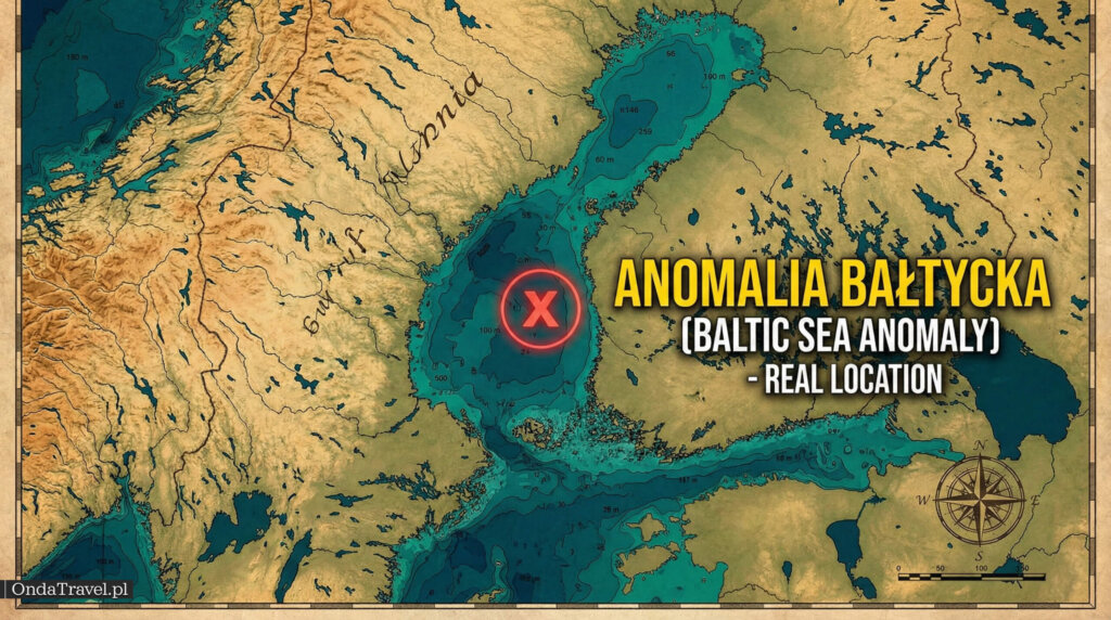
- When and where: detected on sonar in 2011, Gulf of Bothnia region (northern Baltic Sea).
- What we really have as “hard evidence”: single sonar images/reports + expedition accounts; no public package of raw 3D data.
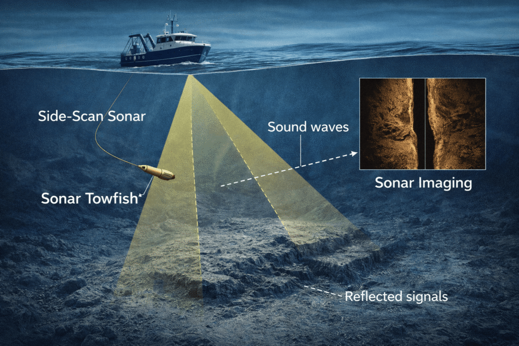
- What is most often misunderstood: sonar is not a photo — acoustic shadows and the scan angle can turn an uneven surface into a “disk”.
- What would settle the dispute: 3D bathymetry (multibeam), sub-bottom profiles, continuous ROV video, and sample analysis protocols.

Facts in 15 seconds:
| Question | Shortest answer | Status |
|---|---|---|
| What is it? | An “anomaly” visible on sonar — an object or formation on the Baltic seabed. | Confirmed: sonar image and expedition accounts exist |
| Where? | Mostly cited: the Gulf of Bothnia area (between Sweden and Finland). | Confirmed in many descriptions |
| When was it detected? | 2011 (often cited as 19.06.2011). | Confirmed in the discoverers’ narrative and discussions |
| How deep? | Approximately 85–90 m. | Confirmed in descriptions; lack of public raw measurement data |
| How big? | Approximately 60 m in diameter. | Confirmed in descriptions; dependent on scan interpretation |
| What is needed to close the case? | 3D multibeam + sub-bottom profiling + full ROV video + independent sample analyses. | Missing from the public data package |
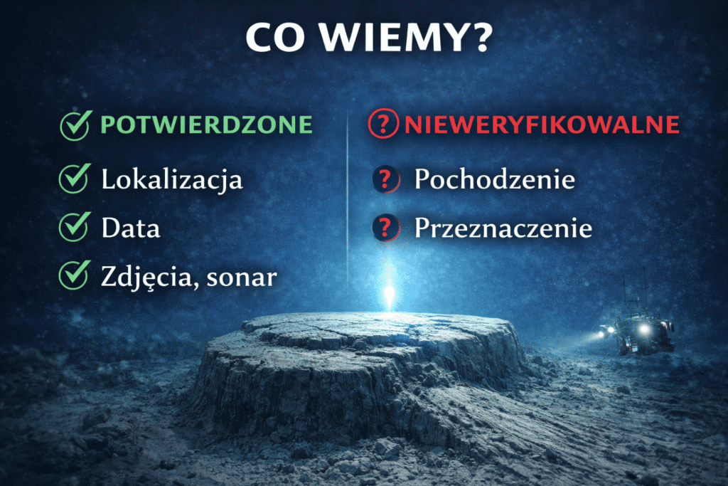
In this post, I treat as “confirmed”:
- the general date and location of detection (2011, Gulf of Bothnia),
- the very fact of an “anomaly” on sonar and its media coverage,
- the fact that interpretations differ because full 3D data is lacking.
I mark as [UNVERIFIABLE] until data is available:
- “mushroom” geometry, hole/hatch and “corridors” (need continuous video/3D),
- “burnt organic material” (need sampling protocols + independent labs),
- electronic interference and military threads (need logs, AIS data, and repeatability).
Jump to sections: use the table of contents below to quickly find the timeline, scientific arguments, and the 2025–2026 updates.
Spis treści


Hi, I’m Krystian “dziadzia przewodnik” from OndaTravel.pl!
The North is my greatest passion, but the world is far too beautiful to stay in just one climate. On my blog, I combine the raw landscapes of Iceland and Norway with the exotic energy of Thailand or Vietnam, showing you how to travel authentically — with passion and a camera in hand.
What will you find on OndaTravel.pl?
Visual storytelling: As a photographer and filmmaker, I don’t just describe places — I take you there with professional photos and video.
North expert: Ready-to-use road trip plans for Iceland and Norway, smart tips for budget travel, and my original Northern Lights Radar (locations and forecast).
Travel through the lens of cinema: I track down filming locations — from icy scenes in Interstellar to tropical frames from world cinema.
New direction: Exotic destinations: I love contrast, so the blog is featuring more and more practical knowledge about Vietnam and Thailand. I’ll show you how to find your way around Southeast Asia and come back with your best memories.
P.S. follow me here

Introduction: A Shadow in the Depths of the Gulf of Bothnia
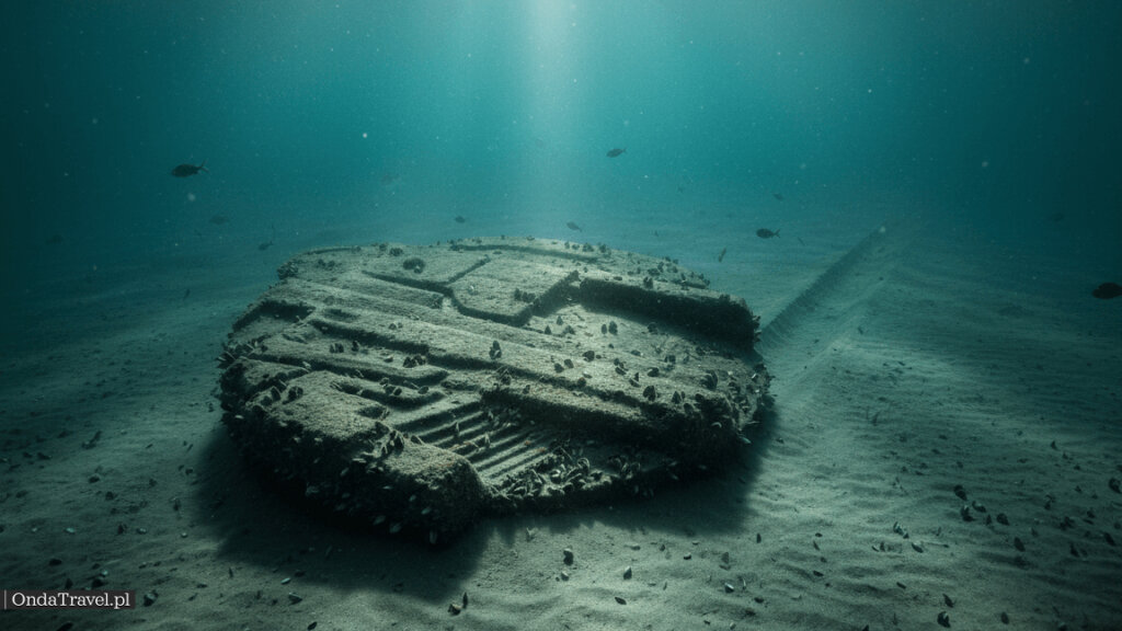
On June 19, 2011, the history of underwater exploration in Northern Europe changed its course irrevocably. What was meant to be a routine return from a search expedition turned into one of the greatest maritime mysteries of the 21st century. Peter Lindberg and Dennis Åberg, founders of the Swedish treasure hunting group Ocean X Team, registered an object on their side-scan sonar that defied their known geological and archaeological classification. This object, resting at a depth of about 85-90 meters in international waters between Sweden and Finland, gained the name “The Baltic Sea Anomaly.”
This text organizes what can currently be verified in public materials about the Baltic Sea Anomaly: dates, the context of the expeditions, the arguments of geologists and the Ocean X Team, and a list of questions for which data is still lacking. If you’re interested in the “UFO in the Baltic” topic, treat this as a guide to the facts — and to the places where the internet legend begins.
In a world where the line between science and speculation often blurs, the Baltic Sea Anomaly remains an “open book” – a kind of Rorschach test for the human imagination and research methodology. Are we dealing with a prehistoric structure, a secret weapon from World War II, a natural glacial formation, or – as some would like – the wreck of an extraterrestrial ship?
Part I: Genesis and Historical Context
1.1. Ocean X Team: Profile of the Discoverers
To understand the significance of the discovery, one must first analyze the profile of the group that made it. Ocean X Team (often confused with the American OceanX) is a Swedish commercial company specializing in locating and salvaging historical cargo from shipwrecks – mainly alcohol and precious metals.
Before 2011, Peter Lindberg and Dennis Åberg enjoyed a reputation as effective, though controversial within archaeological circles, hunters of “liquid gold.” Their greatest success was locating the wreck of the schooner “Jönköping” in 1997, sunk in 1916 by a German U-boat. Thousands of bottles of Heidsieck & Co Monopole champagne from 1907 were salvaged from the ship’s hold, fetching record prices at international auctions.3 This success defined their modus operandi: high risk, high operational costs, but potentially gigantic returns on investment.
The discovery of the Baltic Sea Anomaly occurred when the team was searching for old wrecks from World War I and II. They were not looking for UFOs. They were looking for history that could be monetized. This is a key context that skeptics use to question the find’s credibility, suggesting a marketing motivation in the absence of other successes during that period.
1.2. Why the Baltic Erases Traces: Salinity, Geology, and Shipwrecks
The Baltic Sea is a unique body of water on a global scale. It is a geologically young sea, finally shaped after the retreat of the Scandinavian ice sheet about 10-12 thousand years ago.
Salinity: It is the largest brackish water body in the world. Low salinity and low oxygen levels near the bottom mean that wooden wrecks are preserved in almost perfect condition for hundreds of years (absence of shipworm).
Geology: The Baltic seabed is a “museum” of the Ice Age. Glaciers moved enormous masses of rock material, creating moraines, eskers, and leaving behind gigantic erratic boulders. This geological context is the main argument for scientists explaining the Anomaly as a natural formation.
Military History: The Baltic was an arena for intense military and intelligence activity. From Swedish-Russian wars, through both world wars, to the Cold War – the seabed is littered with mines, submarine wrecks, and, potentially, secret listening installations.
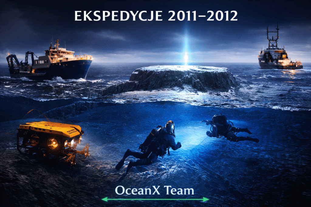


Part II: The Discovery and First Phase of Research (2011–2012)
2.1. Day Zero: June 19, 2011
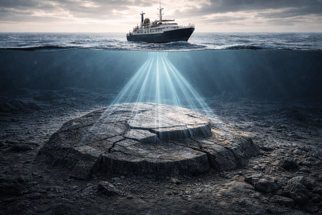
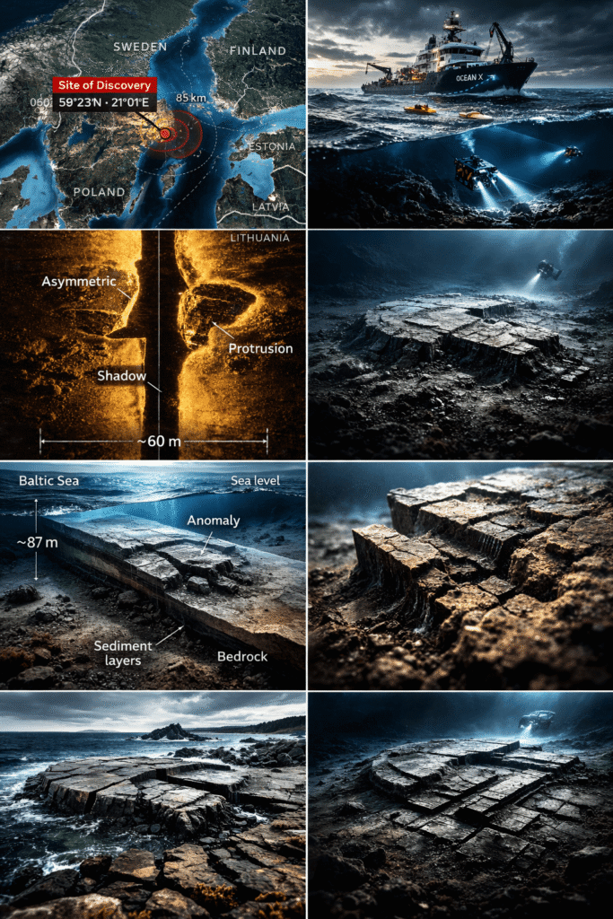
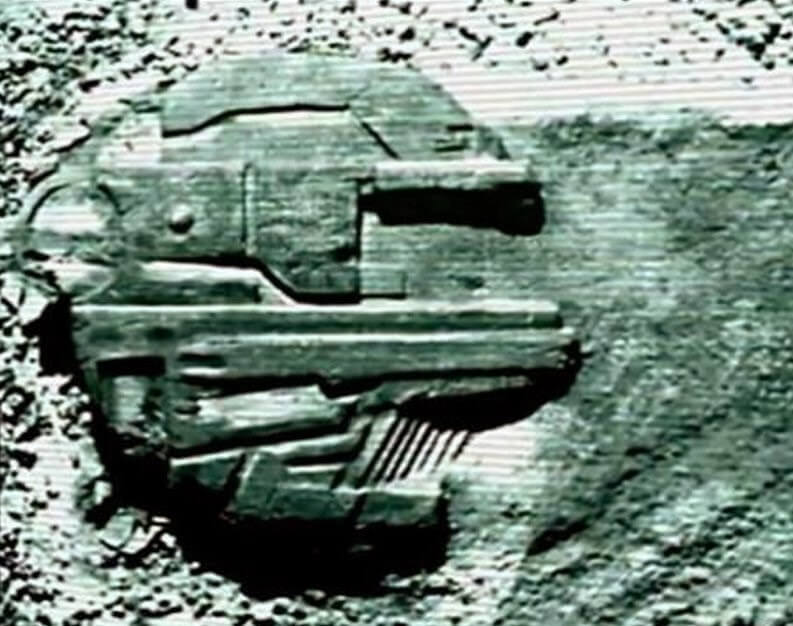
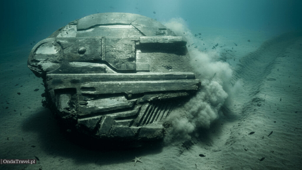
While returning to port, after nine days of fruitless wreck searching, the side-scan sonar of the ship “Ancylus” registered an anomaly on the seabed of the Gulf of Bothnia. The image that appeared on the monitors was grainy and monochromatic (a typical feature of side-scan sonars of that generation), but it depicted a structure of striking symmetry.
Preliminary object parameters:
| Parameter | Most frequently cited value | Status / notes |
|---|---|---|
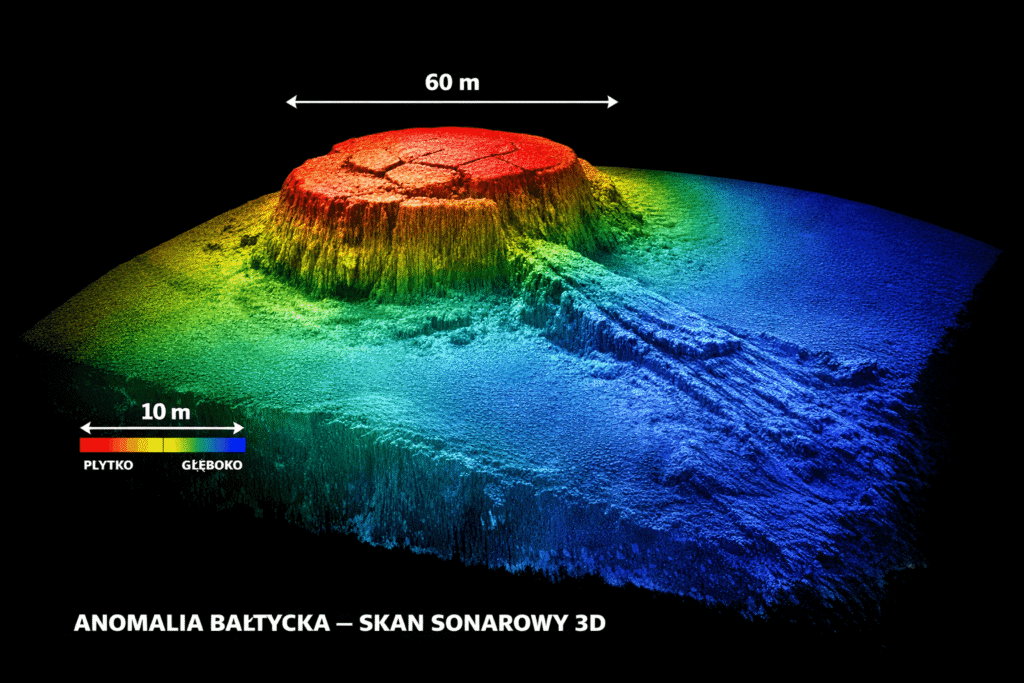
| Width / diameter | approx. 60 m | Cited in discoverers’ descriptions and discussions |
| Height above seabed | 3–4 m | [UNVERIFIABLE] — verification condition: raw 3D data (multibeam) with measurement metrics |
| Depth | approx. 85–90 m | Cited in many descriptions; discrepancies depend on the source |
| “Regular” features | “corridors”, right angles, structures like walls | [UNVERIFIABLE] — condition: continuous ROV video + high-resolution 3D map |
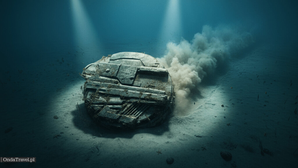
| “Trail” on the seabed | approx. 300 m furrow / strip | Cited in descriptions; interpretation dependent on scan geometry |
Note: “[UNVERIFIABLE]” means that public materials lack raw data or protocols allowing independent confirmation of the detail.
2.2. The “Millennium Falcon” and Media Reaction
When Ocean X Team made the sonar image public, the internet reacted immediately. The object’s shape bore an uncanny resemblance to the “Millennium Falcon” from the Star Wars saga. Peter Lindberg, aware of the media potential, did not shy away from speculation, which triggered an avalanche of publications.
| Media | Headline / Narrative | Date | Impact on public opinion |
|---|---|---|---|
| Expressen / Aftonbladet | “UFO at the bottom of the Baltic?” | 2011/2012 | Local interest, building national pride in the discovery. 8 |
| Daily Mail | “Millennium Falcon found underwater” | June 2012 | Global viral spread, introduction of science-fiction narrative. 5 |
| Internet Forums | Pixel-by-pixel analysis | 2011-2012 | Emergence of “truth seeker” communities, conspiracy theories. |
2.3. The 2012 Verification Expedition: Divers, ROV, and Controversies
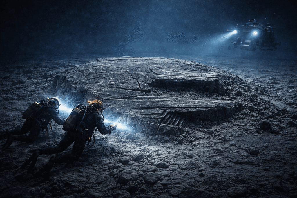
A year after the discovery, an expedition was organized to physically verify the object. Deep-sea divers and ROVs were used. This expedition provided the most controversial data, which to this day fuels the theories about the object’s artificial origin.
Key observations from divers (including Stefan Hogeborn):
Structure: The object allegedly rests on something like a “pillar,” resembling a giant mushroom. [UNVERIFIABLE] — verification condition: continuous ROV recording + 3D map (multibeam) showing the solid shape and point of contact with the seabed.
Surface: Described as “concrete-like” or made of very hard stone, with visible regular lines and right angles (so-called corridors).
Hole and “Soot”: On top of the object, a hole (often described as a hatch or chimney) was found, surrounded by strange stone formations arranged in circles. Furthermore, material resembling soot or burn marks was found, which is an anomaly on the seabed.
Technical Anomalies: In Ocean X Team’s accounts, there is a thread about equipment failure (satellite phone/cameras/lighting), allegedly only when the vessel was directly above the object. These same accounts also state that the equipment “returned to normal” after moving about 200 meters away. [UNVERIFIABLE] — verification condition: equipment logs, test conditions, and repeatable measurements (with “blind” control).
Part III: Scientific Analysis – A Clash of Facts and Interpretations
3.1. What Rock Samples Showed: Comment from a Geologist at Stockholm University
A key moment in the debate over the Baltic Sea Anomaly was the submission of rock samples for laboratory analysis. These samples went to Professor Volker Brüchert from Stockholm University.
Analysis results:
Composition: Most of the material provided consisted of granites, gneisses, and sandstones.4 These are rocks typical of the Fennoscandian Shield.
Basalt: Among the samples was a loose fragment of volcanic rock (basalt). Although basalt does not occur naturally in this specific location on the seabed, its presence is not proof of a “spaceship.”
Professor’s Conclusion: The entire structure is most likely a post-glacial formation. The ice sheet, melting thousands of years ago, transported huge boulders from other regions. The Anomaly is a gigantic erratic boulder that was deposited on the seabed in a specific way, and the “runway” is a trace left by the moving glacier or meltwater.
3.2. How Ocean X Team Responds to Criticism: Arguments and Limitations
The Lindberg and Åberg team did not fully accept this explanation, pointing to weak points in the geological theory:
Right Angles: Nature rarely creates perfect right angles and smooth walls several meters long (although geological joints are known that can produce such an effect).
Separation from the Substrate: In 2025–2026 accounts, a thesis appears that the object may be separated from the seabed by a sediment layer, suggesting it may not be a bedrock outcrop but something that settled on the bottom. [UNVERIFIABLE] — verification condition: publication of raw multibeam/sub-bottom data with methodology and measurement parameters.
Burnt Organic Remains: The presence of material that looks burnt is difficult to explain by glacial processes.
Part IV: Alternative and Conspiracy Theories
The cognitive gap between cool geological analysis and the exciting accounts of divers has been filled by alternative theories. Below is a detailed analysis of them.
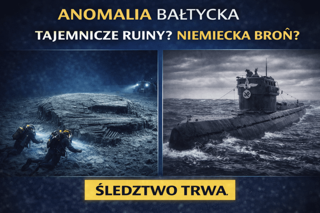
4.1. The “Wellenbrecher” Theory and Secret Nazi Weapons
The Baltic was a key area for Nazi Germany (testing ground, transport route for iron ore).
Hypothesis: The object is a concrete engineering structure from World War II. It could have been a base for an anti-aircraft gun, part of a submarine detection system, or a base for secret V-weapons.
The “Wellenbrecher” Argument: This term (meaning breakwater) appears in the context of defensive doctrine, but conspiracy theorists link it to secret bases.
Vril and Haunebu: An extreme version of this theory suggests it is a prototype anti-gravity ship (Haunebu) based on “Die Glocke” technology, which malfunctioned and crashed into the sea. Electromagnetic interference supposedly comes from its still-active drive.
4.2. The Military Hypothesis: Russian Device, Installation, or Wreck
Given the proximity of Russia and the history of the Cold War, there is a hypothesis that it is a Soviet listening or jamming device, designed to monitor NATO and Swedish fleets. The disk shape could aid stability on the seabed.
Circumstantial Evidence: In 2015, Ocean X Team discovered the nearby Russian submarine “Som” from 1916, confirming their ability to identify Russian equipment.
4.3. The Prehistoric Hypothesis: Megalith, Ancylus, and the “Swedish Atlantis”
Some researchers suggest the object was formed during a period when the Baltic’s level was much lower (e.g., during the Ancylus Lake phase). It could be a megalithic cult structure, flooded after the water level rose. The regular shapes would be man-made, similar to Yonaguni in Japan.
4.4. The UFO/USO Hypothesis: Where It Came From and What Really Undermines It
The most media-friendly theory. Proponents point to:
The “disk” shape visible on sonar (susceptible to image illusions).
The “trail/path” on the seabed interpreted as a furrow or “strip” (interpretation depends on data).
Electronic interference (described equipment failures) — [UNVERIFIABLE] without logs and control tests.
Accounts of strange light phenomena in the area.
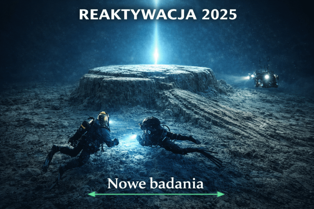
Part V: Reactivation – The Year 2025 and the “Deep Blue Explorers” Project
After years of relative silence, broken only by occasional interviews, the year 2025 brought a breakthrough. Ocean X Team underwent a transformation, becoming part of a larger enterprise.
5.1. Deep Blue Explorers: A New Phase of Activity and an Attempt to Organize Research
In January 2025, Dennis Åberg announced the launch of a new brand – Deep Blue Explorers. Accounts mention attempts to finance activities through commercial projects and partnerships around the expedition (instead of solely through “wreck hunting”). [UNVERIFIABLE] — verification condition: transparent project accounts and a publicly available description of funding sources and the scope of research conducted in the Baltic.
5.2. The June/July 2025 Expedition: New Data
The latest expedition, carried out in the summer of 2025, differed from previous ones due to the involvement of external scientific and technological partners.
Participants: The team included representatives from CQR Robotics (supplier of underwater drones), the French group Sigma 2 (studying UAP in a scientific manner), and scientists from Stockholm University, including Dr. Beatrice Villarroel (known from the VASCO project – searching for astronomical anomalies).
Technology: Multibeam sonar and sub-bottom profiling were used, allowing for a high-resolution three-dimensional image.
Key discoveries from 2025 11:
Independence from the Substrate: In 2025–2026 accounts, the thesis appears that sub-bottom profiling indicates the object lies on a layer of sediment and is not an “outgrowth” of the bedrock. [UNVERIFIABLE] — verification condition: publication of raw sub-bottom cross-sections along with interpretation methodology and measurement parameters.
“Breathing” Phenomenon: A phenomenon of periodic outflow of turbid water from the hole and a local temperature drop is described. [UNVERIFIABLE] — verification condition: continuous ROV video + logs of temperature/salinity sensors with calibration description and measurement time.
Military Activity: Accounts mention the presence of naval vessels near the research site. [UNVERIFIABLE] — verification condition: AIS/NOTAM/NAVTEX data or official communications with specific dates and coordinates.
Summary: The Endless Enigma — Key Facts, Dates, and Context
The Baltic Sea Anomaly remains one of the most fascinating phenomena in modern maritime exploration. Whether it is a geological joke of nature, a remnant of secret Third Reich projects, or a silent witness to a visit from another civilization, this object has forced the world to look into the murky waters of the Baltic with new curiosity.
The year 2025 and the formation of Deep Blue Explorers open a new chapter. The involvement of scientific and technological partners offers a chance that future materials will be in a form that can be independently verified. Until then, the Baltic Sea Anomaly remains an “open case” — interesting, but in many points, evidentially inconclusive.
Interviews 2025–2026: Three Threads You Need to Know to Assess the Case
In new interviews and accounts from 2025–2026, three specific threads recur. They don’t decide the “UFO” question, but — if presented in the form of data — they could strengthen or weaken some hypotheses.
- Sub-bottom profiling: the thesis appears that the object rests on a layer of sediment, not being an “outgrown” part of the substrate.
- Scrapings and traces of high temperature: the thread about “burnt organic material” described in analysis accounts returns.
- More precise mapping and equipment: announcements of better 3D bathymetry and ROV video documentation, reducing the margin for interpretation errors from old sonars.
How to Resolve the Topic Without Guesswork: A Simple Checklist That Ends the Dispute
If the goal is an honest answer, a set of materials that can be checked independently is needed. Here’s what practically closes such stories:
- A high-resolution 3D map of the seabed (multibeam) with measurement parameters and scanning path.
- Sub-bottom profiling cross-sections along with a description of the interpretation method and data quality control.
- Continuous ROV video recording showing the object’s surface with a readable scale (no “gaps” at key moments).
- Samples from multiple points on the object and its surroundings, with a collection protocol and contamination control.
- Independent analysis of results in at least two laboratories and publication of methods.
Updates 2026: What We Know New About the Baltic Sea Anomaly Today
Last update: 18.02.2026. In this section, I gather the most important new information and organize it chronologically.
| Date | What’s new | Why it’s important |
|---|---|---|
| 18.02.2026 | Added summary of threads from 2025–2026 interviews: sub-bottom profiling, scrapings, and announcements of more detailed documentation. | These are the elements that could realistically move the discussion from the level of speculation to the level of data |
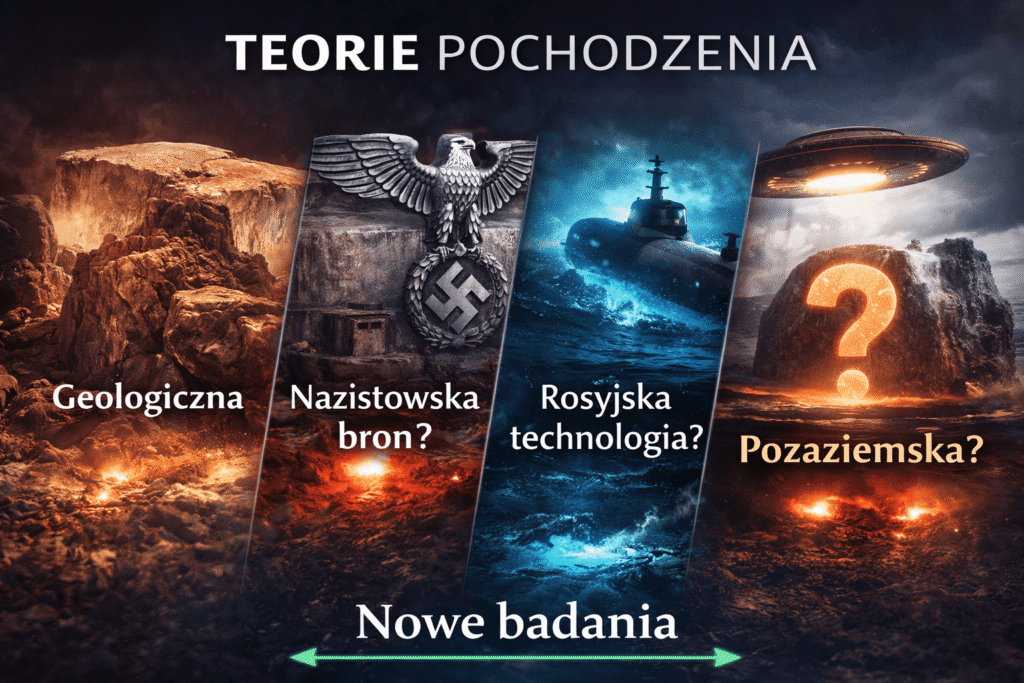
The Most Popular Theories About the Baltic Sea Anomaly: UFO, Bunker, Crater, or Glacier, Unidentified Anomalous Phenomena
Several recurring hypotheses have grown up around the Baltic Sea Anomaly. The following summary organizes them “humanely” — without forcing a conclusion, but also without mixing data with internet legend.
| Theory | Why people believe it | What to check before you believe | Most common mistake |
|---|---|---|---|
| “UFO” / technological object | Sonar shape resembles a disk + virals | Do public 3D data and independent sample analyses exist? | Treating sonar like a photo and ignoring the acoustic shadow |
| Nazi bunker / installation | The Baltic is associated with secret projects and wrecks | Are there any historical documents and the logic of construction at that depth? | Linking every “strange object” to WWII without evidence |
| Impact crater | Round shape + “trail” in sediments | Does the region’s geology and sediments match a typical impact? | Oversimplification: round = crater (not always) |
| Post-glacial formation / erratic boulder | This is the most common, simple geological explanation | Do 3D maps show features typical of glacial structures? | Assuming nature “doesn’t make straight lines” (sometimes it does) |
Glossary of Terms to Understand the Anomaly: Sonar, Bathymetry, and the Gulf of Bothnia
If you want to understand this story without mental shortcuts, these terms appear most often in articles and videos.
| Term | What it means in practice | Why it matters here |
|---|---|---|
| Side-scan sonar | “Sound photo” — an image from reflected acoustic waves | Can create shape illusions depending on angle, shadow, and sediment type |
| Bathymetry (multibeam) | Accurate 3D map of the seabed | The better the resolution, the less room for “eyeball” interpretations |
| Gulf of Bothnia | Northern part of the Baltic Sea between Sweden and Finland | This is where the described anomaly is most often located |
| Glacial sediments | Layers of sands, clays, and gravels from glaciers | Can “mask” the object’s edges and change what is visible on sonar |
| Sub-bottom profiling | Surveying layers beneath the seabed | Can answer whether the object is part of the bedrock or lies on sediments |
| ROV | Remotely Operated Vehicle with a camera | Provides better documentation than diving in the murky Baltic water |
FAQ: Baltic Sea Anomaly, UFO in the Baltic, and Questions People Type into Google
Is the Baltic Sea Anomaly a UFO at the bottom of the Baltic Sea?
There is no public evidence that unequivocally confirms an artificial object. u0022UFO in the Balticu0022 is a media shorthand, not a conclusion.u003cbru003eu003cbru003eThe loudest arguments u0022foru0022 are based mainly on sonar interpretation and expedition accounts. Without a full package of 3D data and independent sample analyses, it is safest to treat this hypothesis as speculation.
Where is the Baltic Sea Anomaly located and at what depth?
Descriptions most often mention the Gulf of Bothnia region and a depth of approximately 85–90 meters (depending on the source).u003cbru003eu003cbru003eExact coordinates are not commonly published in raw form. If 3D maps with measurement metrics appear, it will be easier to compare accounts between sources.
Why does the sonar image look like a disk or the Millennium Falcon?
Sonar shows reflections and acoustic shadows, not a u0022photou0022. The scan angle and seabed topography can enhance the impression of symmetry.u003cbru003eu003cbru003eSide-scan often u0022drawsu0022 an object with its shadow — which is why a circle, edge, and furrow can appear more geometric than they actually are.
What does the sub-bottom profiling thread and u0022separation from the seabedu0022 mean?
This is a method of surveying sediment layers beneath the seabed. In 2025–2026 accounts, the thesis appears that the object rests on sediments, which would be important for interpretation — provided measurement documentation appears.u003cbru003eu003cbru003eKey are raw cross-sections, a description of settings, and the method of data interpretation (so others can replicate it).
Where did the topic of burnt organic material come from?
It comes from accounts of preliminary scraping analyses. Without methods and repeatable results, it remains a lead for further verification.u003cbru003eu003cbru003eTo confirm this, a sample collection protocol, contamination control, and independent laboratory tests are needed.
What would need to appear for the topic to be explained once and for all?
A complete set of 3D data, sub-bottom cross-sections, continuous ROV recordings, and independent sample analyses with full documentation.u003cbru003eu003cbru003eIf these materials become public, most of the u0022UFO vs geologyu0022 disputes could be settled by verification, not guesswork.
Sources and Materials for Fact Verification
If you want to check the facts and see where the most frequently cited information about the Baltic Sea Anomaly comes from, here are a few reliable starting points. This isn’t a “forced list” — rather, places where original accounts (Ocean X Team) and strong skeptical discussions are located.
- Ocean X Team — main page (Ocean Explorer)
- Ocean X Team — posts about “Baltic Sea anomaly”
- Ocean X Team — “A never-before-seen image…” (2012, photo + description)
- Live Science (2012) — interpretation: sediment/glacial formation
- Live Science (2012) — “Second ‘Sunken UFO’ Claim Doesn’t Hold Water”
- Snopes — fact-check “UFO in the Baltic?”
- IFLScience (2025) — summary of the discussion (with further links)
- ExplorersWeb (2025) — overview “natural vs artificial vs myth”
📺 Recommended Material: Return to the Baltic Sea Anomaly (2025 Expedition)
If you want to delve deeper into the topic, I recommend a video from the BaldTV channel, which discusses the conclusions and accounts from the latest 2025 research expedition.
About the BaldTV Channel
BaldTV is one of the most popular Polish channels about historical mysteries and unexplained phenomena. The author intriguingly analyzes source materials and witness accounts – with an emphasis on what can be compared with available information.
About the Film
The video focuses on new data and accounts gathered by Denis Åsberg and the Ocean X team in collaboration with scientists. The video’s author cites, among other things, information that modern research equipment and sub-bottom profiling suggest the object may not be a natural rock formation connected to the seabed.
Key Moments and Highlights (Timestamps)
Click to go to a specific part of the video:
- [03:55] – Basic facts: the object lies at a depth of 90 m and is about 60 m in diameter.
- [08:17] – Breakthrough discovery: sub-bottom profiling showed that the object lies on a layer of sediment and is not part of the bedrock.
- [10:12] – Unexplained failures: GPS and electronics on the multi-million dollar university ship stopped working directly over the anomaly.
- [14:41] – Thermal anomalies: water temperature near the object drops to nearly 0°C, even though it is 4–5°C in the surrounding area.
- [14:57] – “Breathing hole”: account of a mysterious opening from which sediment periodically emerges.
- [17:01] – Mysteries and the military: thread about the presence of warships and official interest in the find (according to accounts discussed in the video).
Related reading / next
If you like mysteries, maps, and expedition stories, you may also enjoy: the main travel & story feed and practical travel guides on OndaTravel.
Hi, I’m Krystian “dziadzia przewodnik” from OndaTravel.pl!
The North is my greatest passion, but the world is far too beautiful to stay in just one climate. On my blog, I combine the raw landscapes of Iceland and Norway with the exotic energy of Thailand or Vietnam, showing you how to travel authentically — with passion and a camera in hand.
What will you find on OndaTravel.pl?
Visual storytelling: As a photographer and filmmaker, I don’t just describe places — I take you there with professional photos and video.
North expert: Ready-to-use road trip plans for Iceland and Norway, smart tips for budget travel, and my original Northern Lights Radar (locations and forecast).
Travel through the lens of cinema: I track down filming locations — from icy scenes in Interstellar to tropical frames from world cinema.
New direction: Exotic destinations: I love contrast, so the blog is featuring more and more practical knowledge about Vietnam and Thailand. I’ll show you how to find your way around Southeast Asia and come back with your best memories.
P.S. follow me here


