Katla Geopark Iceland – Along the Kerlingardalsvegur Road
Katla Geopark Iceland – Along the Kerlingardalsvegur Road to Kerlingar Valley Iceland – GUIDE
Katla Geopark Iceland

See photos and drone videos from the Kerlingardalsvegur road through Katla Geopark to Kerlingar Valley Iceland
Iceland highlands – Iceland Interior – Iceland tourist attractions
Katla Geopark Iceland – Table of contents


? Lubisz moje treści❓ Ja lubię kawę ☕️
Wesprzyj mnie ? dorzucając się do jednej ?
Do you like my content? ❓ I like coffee ☕️
Support me by chipping in for one ☕️

Hej! 👋 Tu Krystian – fotograf, filmowiec, podróżnik i przewodnik.
Uwielbiam dzielić się z Wami tym, co odkrywam podczas moich podróży 🌍📸 uchwycić chwile, które inspirują. ☺️
Jeśli podoba Ci się to, co robię i chciałbyś, żebym mógł pokazać Wam jeszcze więcej – możesz mnie wesprzeć poprzez wpłatę na BuyCoffee ☕💛
Każda wpłata to dla mnie możliwość tworzenia jeszcze ciekawszych materiałów, wyjazdów i inspirujących historii.
Dzięki Twojemu wsparciu mogę kontynuować tę przygodę i zabierać Cię w miejsca, które warto zobaczyć! ✈️
buycoffee.to/ondatravel
Hey! 👋 It’s Krystian — a photographer, filmmaker, traveler, and guide.
I love sharing with you what I discover on my journeys 🌍📸 and capturing moments that inspire. ☺️
If you like what I do and you’d like to help me show you even more, you can support me with a donation on BuyCoffee ☕💛
Every contribution helps me create even more interesting content, trips, and inspiring stories.
Thanks to your support, I can keep this adventure going and take you to places worth seeing! ✈️

Zobacz więcej na Youtube
Zapraszam do subskrypcji mojego kanału, gdzie pojawiają sie filmy z ciekawych miejsc oraz Livestreamy podczas których możesz zadać
pytanie i poznać społeczność!


KODY RABATOWE NA TWOJE ZAKUPY

THE MOST INTERESTING TRAILS WITHIN KATLA GEOPARK
The Kerlingardalsvegur trail through Katla Geopark Iceland and the Kerlingar valley is available for visiting during organized trips in the summer period.
The tour through Katla Geopark in Iceland is available as an additional option on the Iceland tour with OndaTravel.pl between June and September.
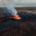
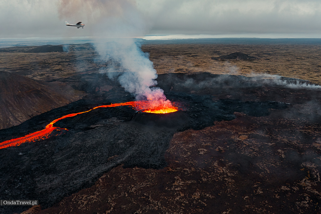
During the four-day expedition, where the main goal was the volcanic eruption “Eruption of the Fagradalsfjall volcanic system in Litli-Hrútur on the Reykjanes peninsula“, I visited several additional cool places.
The eruption in the Fagradalsfjall volcanic system in Litli-Hrútur on the Reykjanes peninsula began on July 10, 2023. The eruption took place near the village of Grindavík, about 30 kilometers from Reykjavík. The eruption is still active and is one of the most spectacular volcanic eruptions in Iceland in recent years. The eruption started in a volcanic fissure about 200 meters long. Lava is emitted from the fissure, flowing down the slopes of the Litli-Hrútur hill. Lava streams reached a distance of about 1 kilometer from the fissure.
If you want to learn more about the eruption itself, I invite you to the article in the NEWS category.
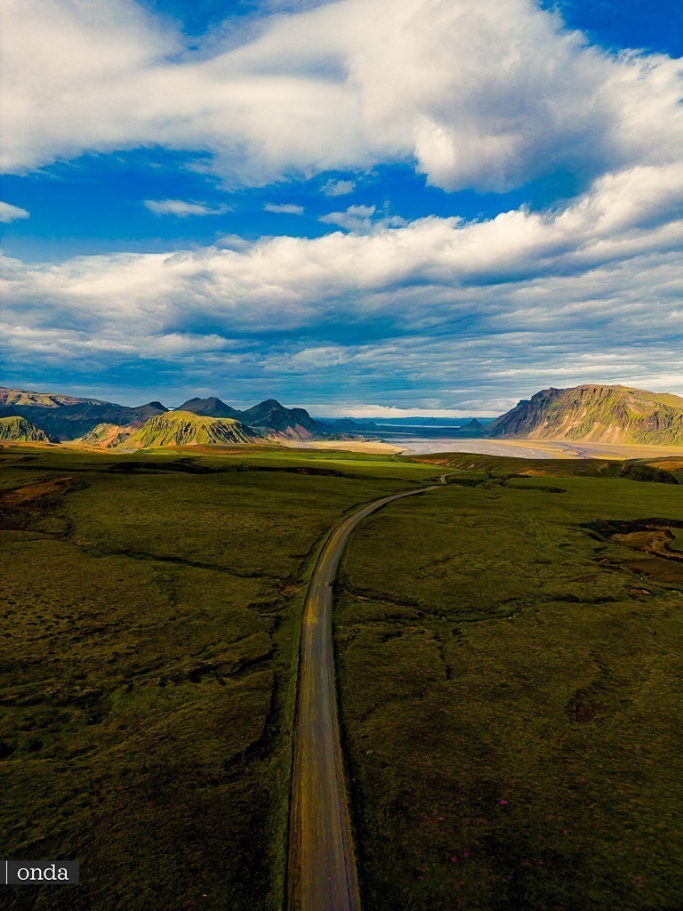
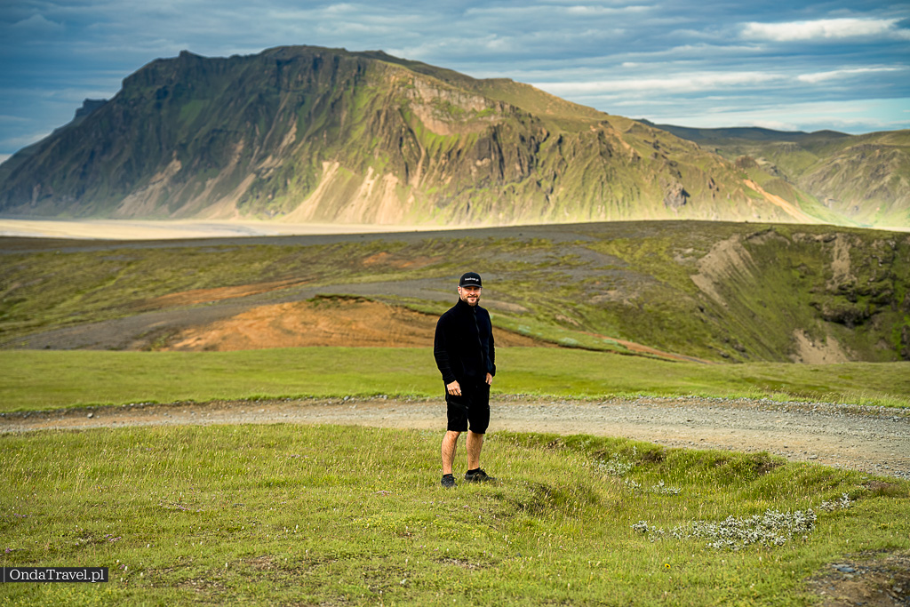
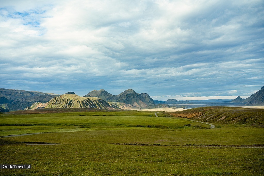
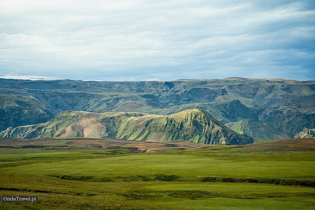
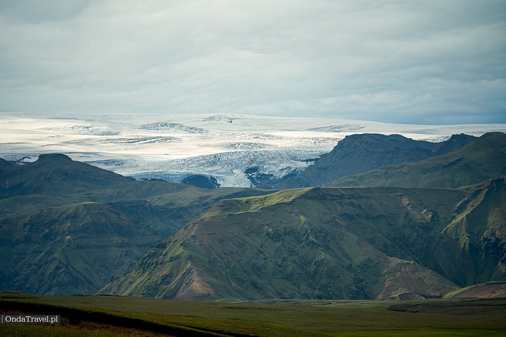
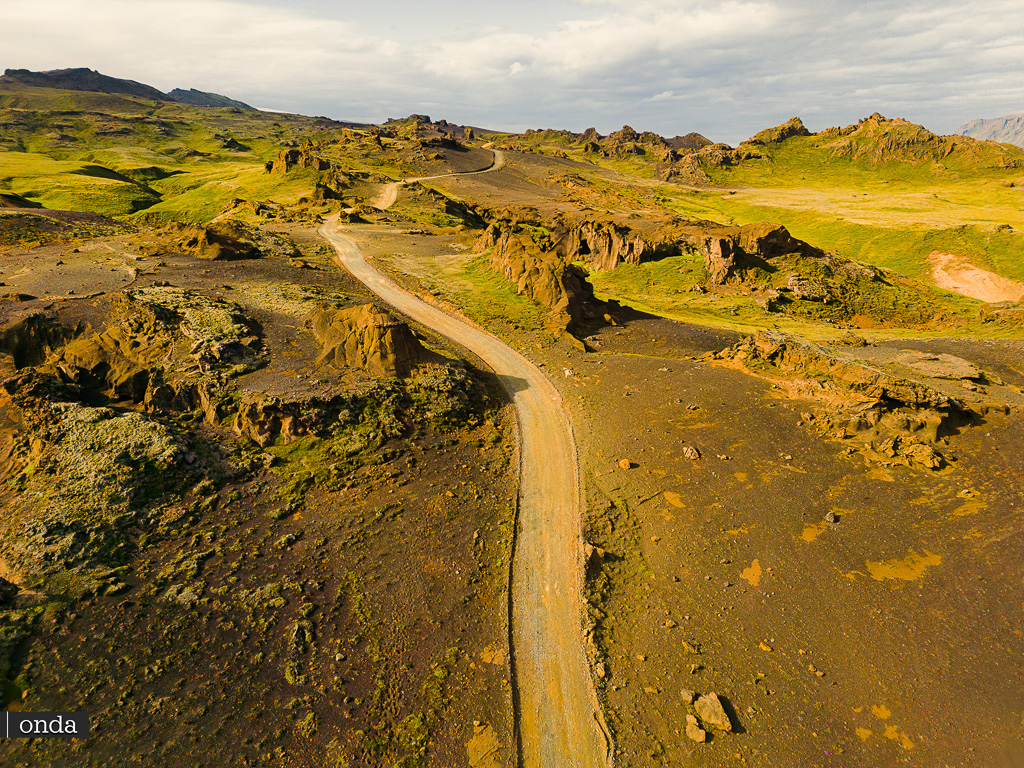
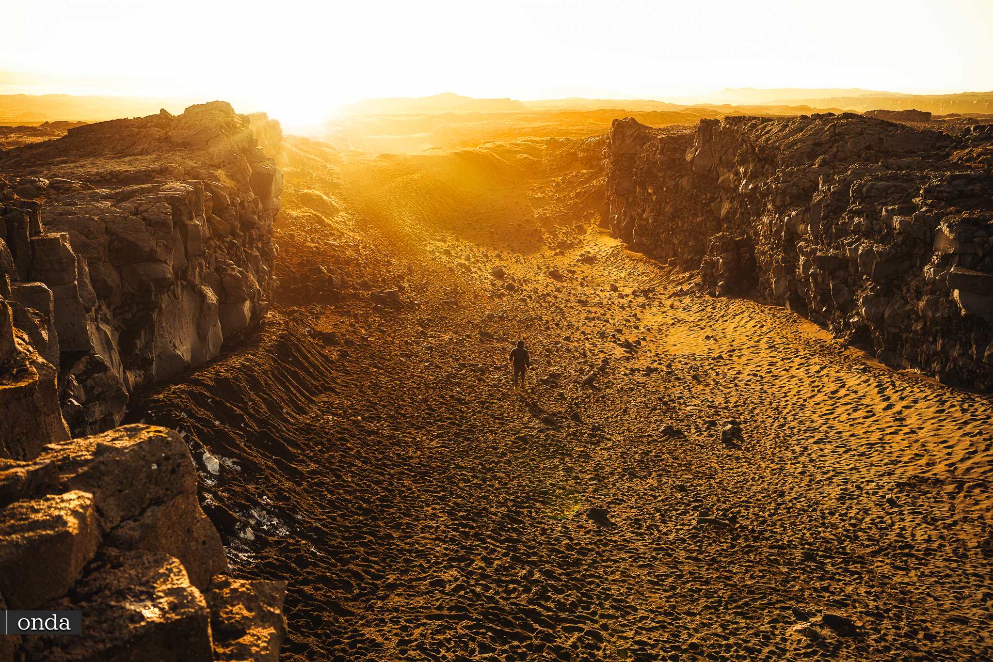
Kerlingardalsvegur Road in Katla Geopark
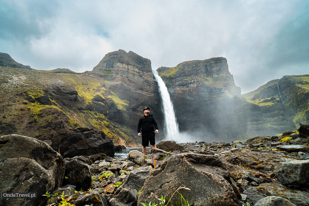
On the way to the eruption, I visited one of Iceland’s highest waterfalls, Glymur
So, getting back to the topic. I additionally visited several wonderful places that, unfortunately, there hadn’t been time for during the round trips around Iceland. This time, I managed to visit, among others, the amazing Glymur waterfall.


Glymur Waterfall is one of the highest waterfalls in Iceland.
Glymur Waterfall is one of the highest waterfalls in Iceland. It has a height of 198 m and a width of 25 m. The waterfall is located in Þingvellir National Park, in southern Iceland. The water from the waterfall falls down a cliff into a narrow valley. There are two trails leading to the waterfall, and here I recommend starting from the bottom, turning right through an amazing cave, through which we continue the trail upwards straight to the top of the waterfall.
A dedicated post rich in my photos and videos, including those from the drone, will be created soon about the waterfall itself.
The next stage “on the way” was the town of Vik and the Dyrholaey cliffs along with the black beach Reynisfjara also known as “Black Beach”.
The next stage “on the way” was the town of Vik and the Dyrholaey cliffs along with the black Reynisfjara beach also known as “Black Beach”. So I reached the park itself late in the afternoon, which was a small mistake, as I write about later.

The main goal of this route was actually the ice cave „Katla Ice Cave”


The main goal of this route was actually the ice cave „Katla Ice Cave”, unfortunately after 11 km on the Kerlingardalsvegur road, which leads to the Kerlingar Valley via Stóra-Laxá, it turned out that to reach the cave itself, an off-road vehicle in a 4×4 configuration, a quad or a buggy is needed, as I saw on the way back. Probably an organized trip of a group consisting of four off-road vehicles. Unfortunately, I was in a beautiful car, which is a VW Polo 🙂


Example trips I found quickly:
From Reykjavík or Vík: Katla Ice Cave and Jeep Tour
Take a full-day guided tour of the south coast of the Land of Fire and Ice from Vík or Reykjavík. Discover the magical ice cave and small hidden trails. Travel round-trip by jeep.
Duration: 3 – 11 hours
Cost: From 843.92 PLN per person

From Vík: Katla Ice Cave, Jeep Tour and Glacier Walk
See the Mýrdalsjökull glacier and explore the extraordinary ice cave under the Katla volcano during this guided jeep tour from Vík.
Duration: 3 hours
Cost: From 823.53 PLN per person


An additional possibility to reach it is, of course, an hour’s trek. I even met two people returning from under the Mýrdalsjökull glacier, which covers the Katla volcano, unfortunately it was already late for the trek itself and it was getting dusk, so not this time.
At the end of the road, there is a turn to the Þakgil campsite (official website thakgil.is a place with reservation possibility) located in a valley between Höfðabrekkuafrétti and Mýrdalssandur. The name of the campsite means “roof of the canyon”.
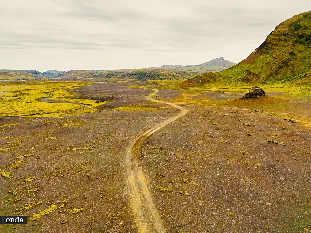
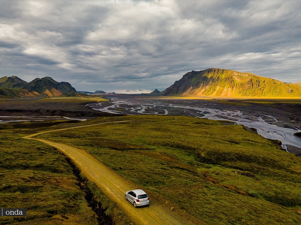
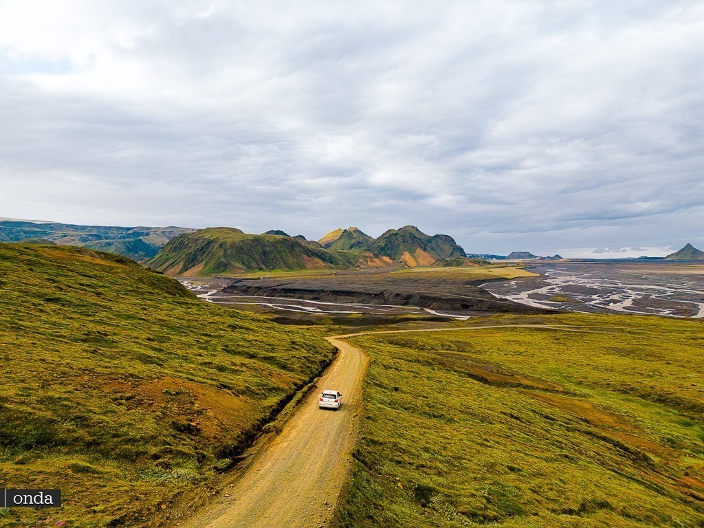
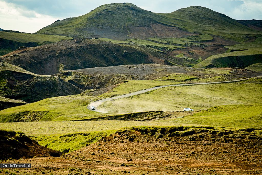
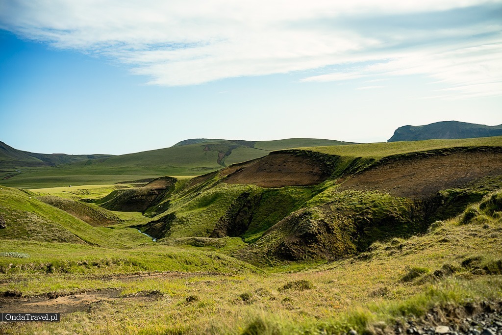
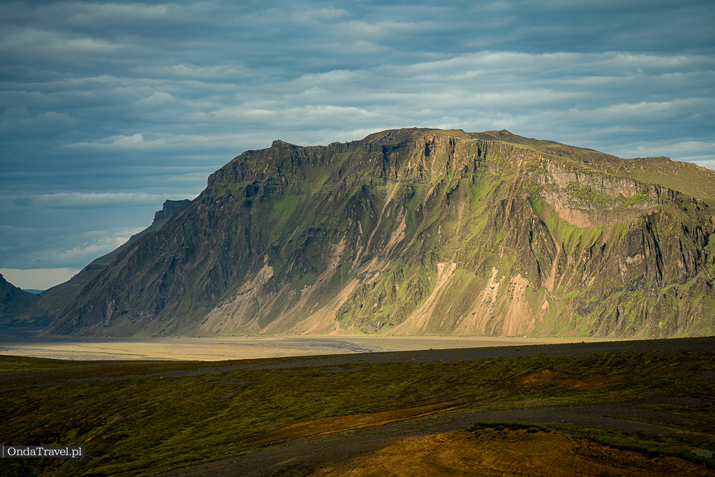
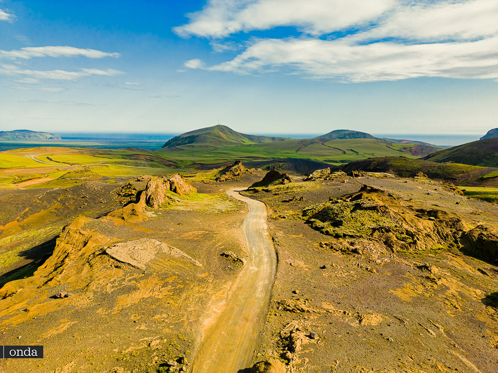
On the Kerlingardalsvegur road you can see many interesting attractions, including:
- Kerlingarfjöll: a mountain range up to 1488 m above sea level.
- Kerlingar: a group of rocks in the shape of mushrooms
- Kerlingarlaug: hot spring
- Thórsmörk: a gorge in the Kerlingar Valley
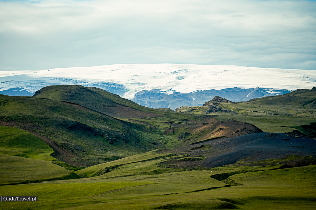
- The Eyjafjallajökull glacier
The Kerlingardalsvegur road is open from mid-June to mid-September.


Other interesting attractions in the area are available on the official website katlageopark.com
Available trekking trails in the area of KATLA GEOPARK :
- Þakgil Trail: This trail leads to the Þakgil canyon, where you can admire beautiful views of the Sólheimajökull glacier and the Mýrdalsjökull mountains. The trail is easy and about 2.5 km long.
- Höldujökull Trail: This trail leads to the Höldujökull glacier tongue. The trail is of moderate difficulty and about 4 km long.
- Mælifell Trail: This trail leads to the summit of Mælifell mountain, from where a panoramic view of the surroundings unfolds. The trail is difficult and about 8 km long.
- Höfðabrekkuheiði: This is a hiking trail about 2.5 km long, which leads through a scenic area with a view of Þakgil. The trail is easy to walk and suitable for all fitness levels.
- Katla Geopark G8+G9 Loop: this is a 15.3-kilometer loop trail located near Mýrdalshreppur, in the Southern Region of Iceland. The trail offers scenic views of the geothermal region and surrounding landscapes, passing through diverse geological terrain.

History of the creation of “Katla Geopark”, Iceland:
Katla Geopark is located in southern Iceland, in a region that encompasses the area around the Katla volcano. The Geopark was officially established on September 29, 2011 and is one of two geoparks on the island (the other is the Reykjanes geopark).
Katla Geopark is the first geopark in Iceland, which in 2011 was inscribed on the list of UNESCO Global Geoparks. The Geopark is located in southern Iceland, in the territory of the municipalities of Vík í Mýrdal and Skaftárhreppur.
The Geopark was created to protect the unique nature, geological landscape and cultural heritage of the region, while promoting ecological tourism.
The Geopark encompasses diverse landscapes, including glaciers, volcanoes, waterfalls, rivers, glacial lagoons, beaches, black sands, and numerous geological formations. It is characterized by a huge diversity of ecosystems, making it an excellent place for nature lovers and travelers seeking unforgettable experiences.


In the area of approximately 9542 km² there are numerous geological attractions, including:
- Katla Volcano is one of the most active volcanoes in Iceland. The last eruption of the volcano occurred in 1918, but the volcano is considered dormant, not extinct.
- Mýrdalsjökull Glacier is the second largest glacier in Iceland. Its surface area is about 1,100 km².
- Mývatn Lake is one of the most beautiful lakes in Iceland. The lake is home to many species of fish, birds and amphibians.
- Seljalandsfoss Waterfall is one of the most popular waterfalls in Iceland. The waterfall has a height of about 60 meters and you can walk behind it, admiring the waterfall from behind.
- Skógafoss Waterfall is another popular waterfall in Iceland. The waterfall has a height of about 62 meters and falls into a narrow crevice in the rock.
- Reynisfjara Beach is one of the most beautiful beaches in Iceland. The beach is known for its black cliffs, basalt columns and black sand.
- Laki Lava Fields are the remains of the eruption of the Laki volcano, which occurred in 1783. The eruption of the Laki volcano caused the death of about 9 thousand people and devastation of crops in Iceland.
- Skaftafell National Park is one of the most popular national parks in Iceland. The park is located on the territory of the Vatnajökull glacier and offers many tourist attractions, including: waterfalls, ice caves, mountains and lakes.
- The volcanic areas of Katla Geopark are an important site for geological research, helping to understand volcanic activity and potential hazards.
- The region is also rich in geothermal activity, including hot springs and geysers.
- On the territory of the geopark you can find interesting archaeological sites, including ancient remains of settlements and farms, testifying to the long history of settlement in Iceland.
- In Katla Geopark there is the popular tourist trail Laugavegur, which attracts trekking enthusiasts from all over the world.

The Skaftárhreppur Municipality is one of the three municipalities in Katla Geopark
Skaftárhreppur is a municipality located in southern Iceland, in the Suðurland region. It stretches between the Mýrdalsjökull and Vatnajökull glaciers, and between the Tungnaá river in the north and the Atlantic coast in the south. The name of the municipality comes from the glacial river Skaftá flowing through it.
The Skaftárhreppur Municipality covers an area of 1,773 km² and has about 800 inhabitants. The main settlement of the municipality is Kirkjubæjarklaustur.
The Skaftárhreppur Municipality is also the site of important historical events, such as:
- The eruption of the Laki Lakagígar volcano in 1783, which caused the death of about 10,000 people and destruction on a large scale.
- The eruption of the Eyjafjallajökull volcano in 2010, which caused the closure of airspace over Europe for several days. Eyjafjallajökull is a 1651-meter stratovolcano with an ice cap at the summit.

YOU MUST KNOW THIS IF YOU WANT TO GO TREKKING IN KATLA PARK
Iceland has a changeable climate, especially in winter, so it’s worth being prepared for rapid weather changes. Roads can be closed in a short time, so it’s good to regularly follow various sources of information that will help in planning safe travels. Here are a few websites worth visiting:
- The official website of the Icelandic Meteorological Office (www.en.vedur.is) is a reliable source of current weather forecasts for Iceland. You can find detailed information there about temperature, precipitation, as well as avalanche hazards, which will help you appropriately adjust plans for trips or outdoor activities.
- To stay up to date with the road situation, it’s worth regularly checking the website www.road.is. You will find an interactive map of the country there, on which current road closures, traffic jams or other hazards are marked, so you can avoid unplanned complications in your travels.
- When planning outdoor activities or hiking, it’s worth visiting the website https://safetravel.is/. This is a website run by the Icelandic Association for Search and Rescue, which provides important information regarding safety while traveling in Iceland. You will find not only weather forecasts and road conditions but also safety tips regarding camping, hiking and other activities in the open space.
Keeping these websites in mind, you will be well prepared for changeable weather conditions and will be able to enjoy safe and successful travels around beautiful Iceland. Remember that following forecasts and updates is key to a successful trip, especially in such demanding atmospheric conditions. May this information help you in planning and enjoying your stay on the island!
Links to interesting and current articles about Katla Geopark, Iceland:
1. https://www.katlageopark.is/ – Official Katla Geopark website with information about geology, history, tourist attractions and events.
2. https://www.facebook.com/VisitKatlaGeopark/ – Official Facebook profile
3. https://www.volcanodiscovery.com/katla/news.html – Current news about the Katla volcano and related seismic activity.
Films and series filmed in Katla Geopark, Iceland:
Katla / series
Locations: Vik, Hlíðardalsskóli
Katla Geopark, due to its spectacular landscapes and volcanic formations, has become a popular location for film and television producers. For example, some scenes of the series “Katla“, produced by the Netflix platform, were filmed in this very region. This place is attractive for filmmakers because of its extraordinary, almost untouched nature, which creates picturesque backdrops for various film productions.
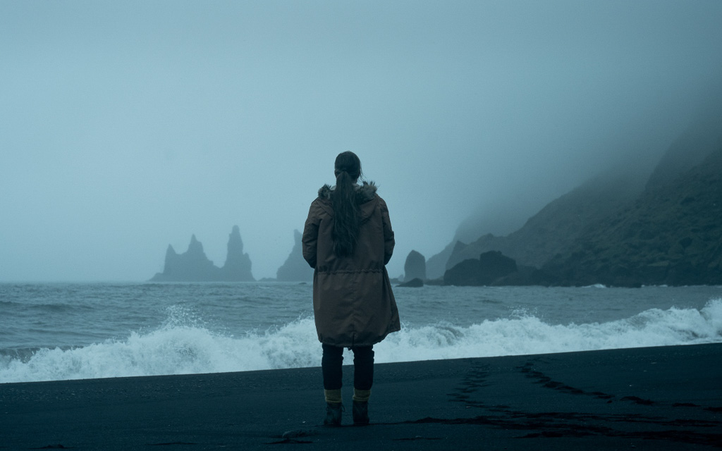


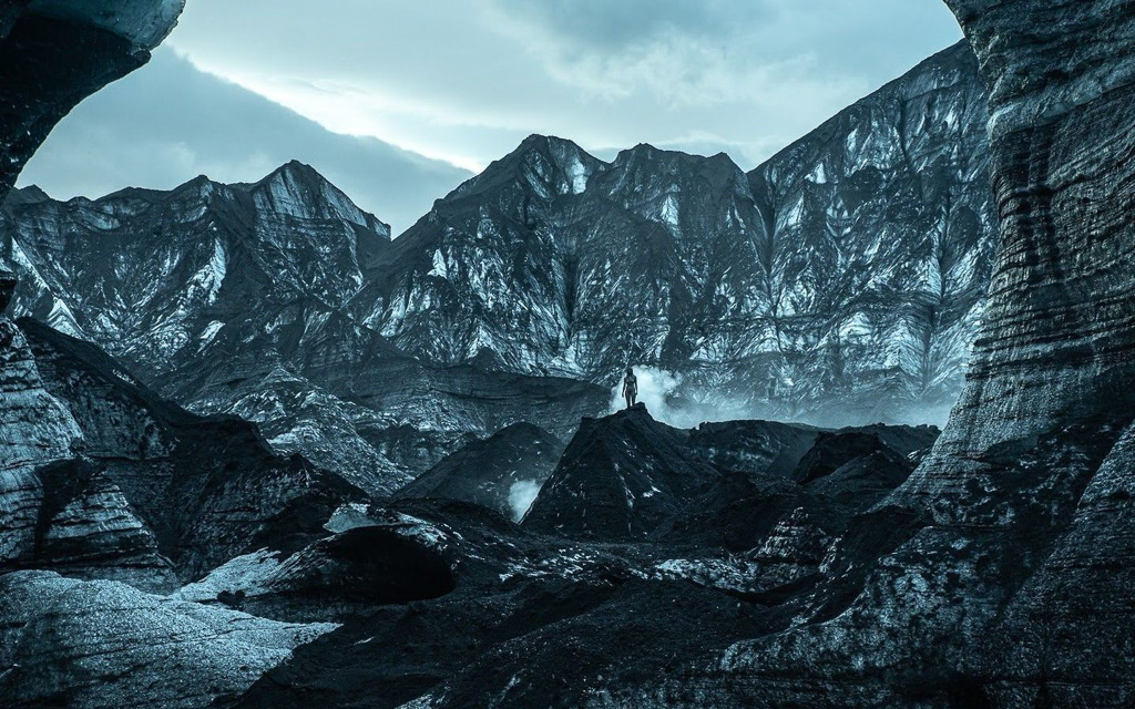


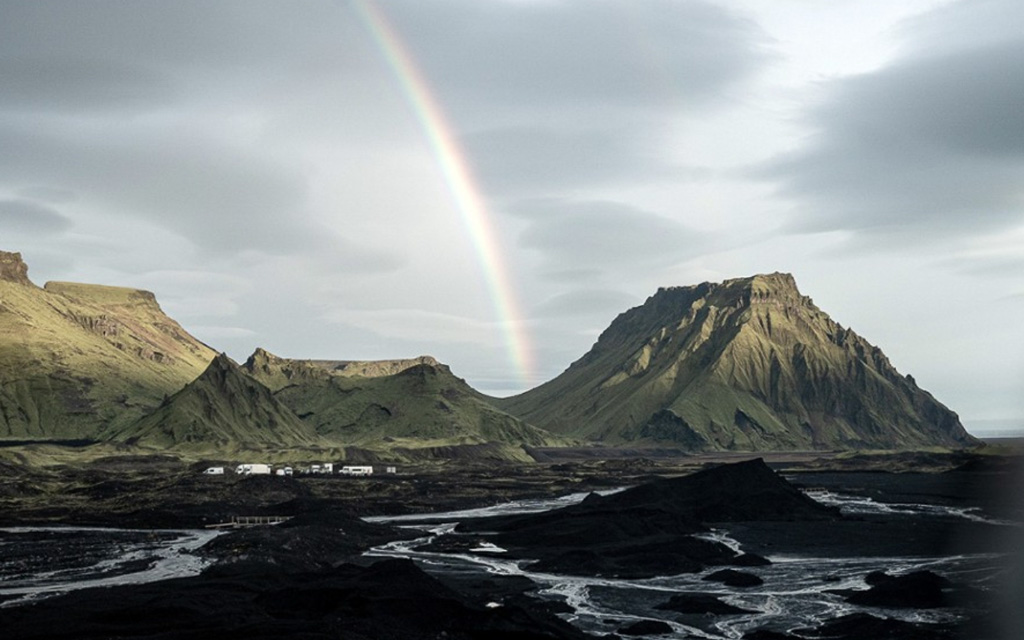

Photo: Netflix
Vikings / series
Locations : Vik, Reynisfjara

Photo: History
Game of Thrones / series
Locations : Volcano, Skaftafell National Park,Svínafellsjökull Glacier,
Episode: The Ghost of Harrenhal (2012)
Episode: The Old Gods and the New (2012)
Episode: A Man Without Honor (2012)
Episode: The Prince of Winterfell (2012)
Episode: Valar Morghulis (2012)

Photo: HBO
See photos and drone videos from the Kerlingardalsvegur road through Katla Geopark to Kerlingar Valley Iceland
What to see in Iceland? The answer is in our guide! A complete tourist guide to Iceland is not only a list of Iceland tourist attractions, but also practical tips and interesting facts about Iceland (e.g., the second oldest parliament in the world!). Check out what is worth seeing in Iceland – from Reykjavik to the Eastern Fjords. This Iceland guide will help you plan the trip of your dreams!
REZERWACJE
W tytule proszę podać wybraną wycieczkę
Islandia wycieczka , Polowanie na zorze polarna

- Kerlingardalsvegur Iceland guide
- route through Katla Geopark Iceland
- what to see Kerlingar Valley Iceland
- Iceland off-road tourist attractions
- Iceland north-eastern coast
- Katla Cave
MORE ARTICLES ABOUT ICELAND AND NORWAY


“`